Search Results
209 results found with an empty search
- Discover the eerie allure of Oculus Anubis in Damascus, Oregon. Unravel the mysteries of Oculus Anubis and explore its dark secrets.
Deep in the woods near Damascus, Oregon, sits the Temple of Oculus Anubis. This sinister place is shrouded in mystery and has been rumored to be a cult gathering site (among a lot of other unsavory things). Many Oregonians have even gone so far as to call it the creepiest place in Oregon! Could this bizarre little shrine of sorts be haunted? Could it be a portal to another world? Could it be a joke? It’s undoubtedly one of the weirdest places in Oregon, no matter its purpose. Located at the end of a quiet street, Oculus Anubis is not your average Oregon residence. The property is home to an ominous black gate, a statue of the Egyptian God Sekhmet, and twin stone pyramids. The bizarre architecture has not gone unnoticed, and many people have deemed Oculus Anubis as the "creepiest place in Oregon." While not much is known about what goes on behind the gate, there are plenty of crazy theories (as there tends to be with any mysterious place). Rumor has it that Oculus Anubis is a cult gathering site and that the property has $2 million worth of underground tunnels. Can this be confirmed? No. Can it be speculated? Definitely. I can understand why there are so many questions about this place. I drove around the block (it is a huge block), and all the side streets leading to Oculus Anubis were all dead ends. Why?? This is another reason to give people some conspiracy theories. So, how did all of these conspiracy theories and mysteries behind this place start? The 41-year-old Anthony Curtis Neal, the son of Sharon Neal, a widow, was prosecuted for health insurance fraud through the Neal family optometry business in Gresham, Oregon. Anthony embezzled around $2.5 million in a decades-long con that was, allegedly, orchestrated by his late father, Dr. Dean Elton Neal. That money fueled what we have come to know as THE TEMPLE OF OCULUS ANUBIS, reportedly spending around $3 million to construct the still-unfinished compound, which includes a 35,000-square-foot house that is unfinished. The statues, gates, a helipad, and a tennis court, too. Remember those tunnels everyone was so enamored with? Well, the tunnels were connecting the houses of the elder and younger Neals. But the tax fraud perpetrated by a medical professional, the exploitation of the trust of their patients, and subsequent embezzling of millions isn’t the worst of it. The jig was up when Anthony fired a surgeon at their practice for not subscribing to their practice of fraudulently billing health insurance agencies for unnecessary tests. It was in April, at Anthony Neal’s sentencing, that we now have the most accurate and chilling peek behind those Anubis gates and into the secretive family therein. Anthony’s defense spurned the Neal family for his transgression, especially the late Dr. Dean Neal. Anthony Neal’s defense lawyer claims that not only is Anthony mentally disabled, landing somewhere on the autism spectrum, but when he was 13 years old, Anthony revealed that a family acquaintance of his father had raped him. Dr. Neal refused to report it for fear of tarnishing his image. Ironically, it would be his image that would receive the most degradation in this case. Contrary to the image they portrayed to their patients, Dr. Neal was a long-time victimizer and tyrant to his family. Dr. Neal seemed to be less of a rich-whacky-isolated millionaire in the vein of Howard Hughes and more of a bat-shit—perverse-despot like Caligula, lacking empathy for his loved ones to terrifying degrees, as he is alleged to have not only abused his disabled son, but repeatedly bound and raped his wife, Sharon. The latter of which is evidenced by a restraining order Sharon had taken out against Dr. Neal in 1997. Dr. Neal died from a stroke in 2015 with no resolution to his domestic terrorism or financial crimes. Anthony’s judge sentenced him to a year in federal prison and was unsurprisingly ordered to pay millions to insurance agencies and the IRS. Judge Jones finished by advising Anthony, “You are not dumb. You were certainly under the thumb of your father, but you knew right from wrong. So, you have culpability." Though the judge was not without surmising that Dr. Dean Neal was "about as evil a person you can imagine, especially involving his disabled son.” Dr. Neal's reign of terror behind those clandestine gates may not have been preternatural, so to speak, or he may not have been in service of the New World Order. Still, for all the fanciful fears Oregonians attributed to the Oculus Anubis, they weren’t far off the mark when tuning to the darker side of their suspicions. To quote the podcast Sword and Scale, “Sometimes the worst monsters are real,” and there are no worse than an abusive father and husband left free to debase and desecrate his family, only to languish without retribution until his natural death. Today, Oculus Anubis still has a bunch of visitors, and some of them try to trespass onto the property to try and prove some of the conspiracy theories. Because of this, the police no longer come out here and answer 911 calls. This has prompted the owner of the property to take other measures. They also have perimeter alarms that will flash with a red light and emit barking sounds. This alerts the dogs on the property where you are.....so good luck. Because of the mystery surrounding Oculus Anubis, there are also numerous fake websites all over the internet. If you do a Google search, you will see a website that is promoted as Oculus Anubis Wellness Center. This looks pretty real, and they are asking for donations, but it is fake. You can check out that website here: https://oculusanubis.com/ Here are several other fake sites you will find on the internet, and they are posted near the black entrance gate. This place is creepy, weird, obscure, and even bizarre. Because of this, I can see why there would be so many conspiracy theories. No one knows what goes on behind the closed black gate, and considering the property's history can lead to all sorts of speculations. Please note that this creepy place is located on private property, so please admire it from afar or gain permission to explore from the landowners. What do you think is going on at this mysterious place in Oregon? Please share your thoughts with me in the comments section. Places to Stay: Cozy Cottage at Dragonfly Horse Ranch Camas Boutique Hotel You can show your appreciation with a virtual coffee if you have found value in my blog. Do not forget to subscribe to get my monthly newsletter. Some of the links found on my website are affiliate links. I earn from qualifying purchases as an Amazon Associate and an Expedia Associate. Through other links, I may also receive a small commission at no extra cost to you. Using them is a way of supporting me, helping me offset the cost of running this website, and ensuring that I can continue providing free content and resources. I truly appreciate the support!
- Explore Virginia City Nevada, a historic mining town rich in history and haunted tales. Discover Virginia City Nevada's unique charm today!
At its peak, Virginia City, Nevada, was a thriving, vibrant metropolis of 25,000 residents. Located about 35 miles southeast of Reno, Nevada. Silver and gold were buried deep beneath the streets, and men and women traveled from around the world to live and work. Miners pulled millions of dollars from shafts and tunnels 3,000 feet beneath the thriving town. The spirit of those Comstock “originals” still inhabits the places where they once worked, lived, worshiped, educated, and died. The 19th-century mining bonanza that turned Virginia City into the most important industrial city between Denver and San Francisco was the result of the Comstock Lode. A rich deposit of silver ore was discovered by Henry Comstock, part-owner of the property on which it was found, in June 1859. Getting his nickname for only making pancakes for breakfast, Henry T. “Pancake” Comstock was referred to as one of the original finders of gold in Gold Canyon, just south of Virginia City. Comstock was said to have been lazy, employing American Indians on his claims, and was a fast talker. Since he was on the scene of the original findings, his name stuck almost instantly. It’s one of the only places where you can walk through town and still see and go into buildings and locations that were built in the late 1800s. Some of the Saloons still have bullet holes in the walls from gunfights back in the 1800s. Boomtown pioneers like the Masons, Pacific Coast Pioneers, Knights of Pythias, Virginia City Firemen, Jewish and Catholic residents, and more formed a total of 14 cemeteries that, today, make up the city’s official Silver Terrace Cemetery. This cemetery is also extremely haunted, and you'll want to bring a camera with you because there are so many breathtaking statues and intricate headstones you'll want to photograph. It’s been noted that strange glowing lights and orbs have been seen floating around many of the older gravesites. Also rumored is the ghostly apparition of an old groundskeeper who wasn’t very friendly. Then there are the stories that tombs have shifted or moved unsuspectedly! The cemetery is so popular that it offers annual tours around Halloween. There are also self-guided audio tours, and you can download an app for this. There are 4,000 people buried at Silver Terrace Cemetery; however, the site only has about 1300 headstones remaining. There are at least thirteen places in Virginia City that are haunted. The Mackay Mansion is one of them. Comstock Millionaire John Mackay may have made a deal with the devil to save his famous Mackay Mansion while the Great Fire burned nearby areas; the mansion was unharmed. Although the Mansion remains intact, seven or more spirits have been seen inside or around this mysterious mansion. Mackay’s wife has been heard wandering through the halls, searching for her lost lover. The Delta Saloon, initially opened in 1865, is one of the oldest, most historic properties in Virginia City. The Delta Saloon and Casino is home to the infamous Suicide Table, where heavy gaming losses led to gamblers losing their lives in the height of the mining and milling period. Truth be told, one Black Jake reportedly lost $70,000 in one night before turning a gun on himself. After two more suicides, the table’s name was famous, and the decision to cease dealing on it was made. Today, the table is still located in the Delta Saloon, where people can see the deadly table, but to prevent risky gambling, it is protected under Plexiglass. Built in 1870 as a luxury bar called the Millionaire’s Club, the Old Washoe Club was known as an exclusive high-status meeting place for the men in Virginia City. With a brothel up the spiral staircase and a large freezer called “The Crypt,” it is no wonder strange happenings occurred here. For many years, the death toll of this club was on a roll. An explosion killed 12 people in 1873, several suicides, missing prostitutes, and bodies stored in the crypt all could account for the sense of spirits in the Washoe Club. Today, you can take a tour of the building’s haunted history – guided tours are available throughout the week and last about an hour. The “Millionaires Club” is also available for overnight investigations. Yes, your group can be locked down in the Washoe Club for a full investigation, just like Zak, Nick, and Aaron from the Travel Channel original series, Ghost Adventures. For $400, your group will get access to all three floors of The Washoe Club, the crypt, and the spiral staircase. All that is required is that each member of your group become a basic member of The Washoe Club Restoration project at the $20 level. The Super Chicken is a place where you can find souvenirs. The original jail. The BUCKET of BLOOD Saloon. This structure was constructed in 1876 after the great fire of 1875, which destroyed up to a thousand structures in the town. Most of the town’s core buildings were lost or sustained damage, unfortunately the first structure that previously occupied this location, like a lot of the other town’s buildings of that time was destroyed. Though the building you are currently viewing has gone through several renovations, iterations and operations since 1876, it like many of the other historical buildings throughout Virginia City survive as living history. Unlike the name, this building does not appear to be haunted, and there were no murders in this saloon. If you do decide to come in and have a drink, I highly recommend the Cemetery Gin, it is distilled with Nevada pine nuts. The Chollar Mansion is a historic Victorian Italianate style house that was built between 1862 and 1864. The residence was listed on the National Register of Historic Places (NRHP) in 1993. It was deemed significant for its association with William "Billy" Chollar, a miner whose Chollar Mine, later merged with Potosi Mine to form the Chollar-Potosi Mine, tapped part of the Comstock Lode and yielded enormous amounts of silver ore. Today, the Chollar Mansion serves as a bed-and-breakfast. Built in 1875, the Fourth Ward School was one of the largest and most impressive schools in the area. After years of neglect, the Ward was closed for more than 50 years. Repairs were made, and it was reopened in 1986. Today, the building is still open as a museum, but the spirit of former teacher Miss Suzzie can still be seen searching the grounds for her students. Pioneer Emporium is another Souvenir Shop. The Palace is a great place to grab a bite to eat and enjoy a beer. Grant's General Store has a Mark Twain Museum. I wanted to check out the museum, but this place is temporarily closed. Here are a couple of more stores, and I love the look and feel of Virginia City. Nevada State Firemen's Museum and Comstock Firemen's Museum were founded in 1979 by Virginia City’s volunteer Fire Department. This museum displays 19th-century firefighting equipment. There are many artifacts relating to the history of firefighting on both the Comstock and throughout Nevada. Liberty Engine Company No. 1 is still an operating volunteer firefighting unit. The Silver Dollar Saloon is about as authentic and local as you can get. The narrow stairs lead to this hangout, a level below C Street. Known for its homemade Bloody Mary's, $2 beers, and great company, this hidden gem has a back deck that overlooks Virginia City’s 100-mile view. Ponderosa Saloon has more than 150 years of history, previously the Sharon House and home of the old Bank of California vault from 1864. Take the 25-minute guided underground mine tour with over 300 pieces of antique mining equipment on display. Take some time and check out the old walk-in bank vault also. St. Mary's in the Mountains is the oldest Catholic Church in Nevada. An unmistakable fixture on the Virginia City skyline, this historic church has been the grand champion of landmark churches in Nevada since it was erected in 1870. Though there are many impressive, historically restored churches peppered throughout Nevada ghost towns, Saint Mary in the Mountains is in an entirely separate class; it’s an untouchable model of historic preservation after a series of disasters. As the first Catholic Church in the state of Nevada, this religious institution still operates as a working Catholic Church. It welcomes all visitors to explore the free museum in the basement that outlines the history of the church itself, Catholicism in Nevada, and what life was like on the Comstock during Virginia City’s formative, boom years. Like most other businesses in town, most of the church was destroyed in the Great Fire of 1875. By the time the 1950s rolled around, the former glory of Saint Mary in the Mountains had waned, and the church was in severe decay. There was a conversation among area bishops that the “Gothic” look was no longer relevant, the church was “too worldly,” and essentially, embraced boring historic components of an already “old religion.” To reinvent the church to make it more interesting to younger audiences, a group of Cistercian monks from Wisconsin was recruited, who later became known as the “Mad Monks”. They took over management of the church in 1957 and essentially took an immeasurable toll on European craftsmanship and historic, invaluable features in the church. Original 1870s stained glass was smashed and broken, the choir loft was ripped out (structurally damaging the building), and religious figures were transformed into abstract-modern-style installations. The Mark Twain Saloon & Casino was built in 1863 and is one of less than 10 percent of buildings that survived the “Great Fire of 1875. It has almost always been a saloon, but was not named the Mark Twain until the mid-1950s. THE FACE UPON THE BARROOM FLOOR is mentioned quite a few times in American folklore, but they think it may have the face that started it all! Theirs may not be the one that later ended up in popular songs and poems, but the face painted on the floor of the Mark Twain Saloon & Casino might have the most famous subject: beloved courtesan Julia Bulette. The artist was rumored to be none other than the man that they say eventually took her life — a French drifter named John Millian. I couldn't get a good picture of the Face on the Floor, so I took this one off the internet. Suppose you want to go back in history and spend some time in the Wild West, then Virginia City, Nevada, is the place to go. The entire town still looks and feels as if you are in the 1800s. This town is also a great place to investigate paranormal activity, boasting at least thirteen haunted locations. They include Silver Queen Hotel, Historic Fourth Ward School, Sugar Loaf Mountain Motel, Piper’s Opera House, Mackay Mansion, Storey County Courthouse, Old Washoe Club, Vacant Lot, Silver Terrace Cemetery, St. Mary’s Art Center, E. Clampus Vitus Building, Gold Hill Hotel, and Delta Saloon. Come here around Halloween to have a great time and spend one night at Silver Terrace Cemetery, and another night at the Old Washoe Club. If you do come here and have a paranormal experience, I would love to hear about it. Whether you have a paranormal experience or not, this is one little awesome town to visit. Places to Stay: Echo Suites Extended Stay Reno Sugarloaf Mountain Motel You can show your appreciation with a virtual coffee if you have found value in my blog. Do not forget to subscribe to get my monthly newsletter. Some of the links found on my website are affiliate links. I earn from qualifying purchases as an Amazon Associate and an Expedia Associate. Through other links, I may also receive a small commission at no extra cost to you. Using them is a way of supporting me, helping me offset the cost of running this website, and ensuring that I can continue providing free content and resources. I truly appreciate the support!
- Explore the haunting beauty of Bodie, California, a ghost town preserved in time. Discover Bodie, California's rich history and eerie allure.
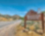
Bodie, California, is a town frozen in time and preserved by California State Parks in a state of “arrested decay.” Bodie became a State Historic Park in 1962and maintains the buildings just as they were found when the State took over the town. They do not restore the buildings; instead, they choose to preserve them in their aged and weathered 1880s appearance. Bodie's story began in 1859, after the significant Gold Rush period in California. When four prospectors struck gold in a small valley 75 miles southeast of Lake Tahoe. The prospectors came to this specific part of California, known as the Mother Lode region, in search of the much-sought-after gold. This small, gold-laden valley and the now developed mining outpost were hit by a violent blizzard shortly after the four prospectors discovered the gold. W.S. Body, one of the four, died as a result of the blizzard. This death gave the freshly settled district its name. The district’s name spelling changed in 1862 when a painter who lived in the next town overwrote a sign that read “Bodie Stables.” When the residents preferred the misspelling to the original “Body,” the district permanently changed it to “Bodie.” Bodie, California, is one of the largest, best-preserved ghost towns in the United States. It covers about 500 acres of land. Here are some pictures of various locations in the town. In 1859, William (a.k.a. Waterman) S. Bodey discovered gold near what is now called Bodie Bluff. A mill was established in 1861, and the town began to grow. It started with about 20 miners and grew to an estimated 10,000 people by 1880! By then, the town of Bodie bustled with families, robbers, miners, store owners, gunfighters, prostitutes, and people from every country in the world. At one time, there were reported to be 65 saloons in town. Among the saloons were numerous brothels and ‘houses of ill repute’, gambling halls and opium dens – an entertainment outlet for everyone. , Here’s the Standard mill, which processed ore from the Standard Mine. (The mine was initially named the Bunker Hill mine when it was first registered in 1861.) Most of the inner workings are still intact. During the summer months, Park Aides conduct a history talk and guided tour (for a fee) where you can see some of the interior of the mill. There is a limit on the number of people per tour, and they only do a few tours a day, so make sure the Museum is your first stop when you get in town to get your tickets, as they do sell out. You can also book private group tours by contacting the Park. Daily, miners would emerge from the mills and head for the bars and the red-light district to spend their earnings. The mixture of money, gold, and alcohol would sometimes prove fatal. Newspapers reported that townspeople would ask in the mornings, “Have we a man for breakfast?” Meaning ‘Did anyone get killed last night?’ In 1876, the Standard Company discovered a profitable deposit of gold-bearing ore, which transformed Bodie from an isolated mining camp comprising a few prospectors and company employees to a Wild West boomtown. Rich discoveries in the adjacent Bodie Mine during 1878 attracted even more hopeful people. By 1879, Bodie had a population of approximately 7,000–10,000 people and around 2,000 buildings. One legend says that in 1880, Bodie was California's second or third largest city. Over the years 1860–1941 Bodie's mines produced gold and silver valued at an estimated $34 million (in 1986 dollars, or $85 million in 2021). As a bustling gold mining center, Bodie had the amenities of larger towns, including a Wells Fargo Bank, four volunteer fire companies, a brass band, a railroad, miners' and mechanics' unions, several daily newspapers, and a jail. At its peak, 65 saloons lined Main Street, which was a mile long. Murders, shootouts, barroom brawls, and stagecoach holdups were regular occurrences. As with other remote mining towns, Bodie had a popular red-light district on the north end of town. There was also a Chinatown at one point, and it had several hundred Chinese residents along with a Taoist temple. Opium dens were plentiful in this area. This is a map of Bodie, California, for fire insurance purposes. Credit: Library of Congress, Geography and Map Division. Bodie also had a cemetery on the outskirts of town and a nearby mortuary. It is the only building in the city built of red brick three courses thick, most likely for insulation to keep the air temperature steady during the cold winters and hot summers. The cemetery includes a Miners Union section, and a monument erected to honor President James A. Garfield. The Bodie Boot Hill was located outside of the official city cemetery. Here is a picture of the cemetery. Some pictures of the mortuary. It didn’t take long for the inevitable in Bodie; a mere couple of years after the immaculate growth of the town, the decline began to set in. The expensive machinery used in the multiple mines and mills needed more expensive upkeep and supplies. Hardly any gold was being found anymore. Residents weren’t able to work in a mining town that wasn’t much of a mining town. A few mines that seemed so hopeful just a year or two prior were abandoned entirely, and the developed companies weren’t coming out with much more than mere silver. Even before the new year of 1881, people began leaving Bodie, seeking the next profitable town. The boomtown’s population dwindled until it reached a tiny population of about 800. For those 800 people, Bodie had just enough left in it to support them for three more decades; however, barely. While some companies were still able to continue digging their mines, even when they found gold, it was hardly enough for the company, let alone the workers. Finally, the digging and mining stopped, proving fruitless. The already low profit coming into Bodie continued to fluctuate, but ultimately it plummeted. Companies tried to cut down on expenses in any way they could, but more residents left. The very first company to form from Bodie's prime, the Standard Company, gave up in 1913, deeming Bodie depleted of riches. The Standard was the town’s wealthiest mine and company. The remaining handful of companies still open continued the struggle to stay afloat. The years following Standard’s closing, some hopeful prospectors tried to revive Bodie's hills and mines, but to no avail. New technology of the 1900s motivated companies to attempt to rebuild Bodie's economy. By the time World War II and its hardships hit, barren Bodie was abandoned once again. Not long after, Bodie's population dropped to zero. Residents left whatever they couldn’t carry behind in Bodie. Old shelves in general stores and bars were left stocked, and people left furniture and structures all behind. Boone Store and Warehouse. Chock full of hundreds of interesting artifacts from the years gone by, this 1879 building was owned by Harvey Boone (incidentally, a direct descendant of Daniel Boone). In July 1884, this building was almost destroyed by a fire that gobbled up the buildings from Boone’s store to Kingsley’s stables – practically the entire block of Green Street. Among the many items still in the store are several original Edison light bulbs that have been continuously burning for several years. Displayed in the front-right window, you can see familiar name brands from today, such as "Kellogg's Tasteless Castor Oil", "St Joseph's Aspirin", and "Colgate medicated powder". The Warehouse. When you first walk into town from the parking lot, the large building on the left is the Methodist Church. The structure was built in 1882 and was one of the two churches in town. The last standard church service was conducted in 1932, when all but a few families had left Bodie. The small wooden structure to the front-right of the entrance is a woodshed that was added on after the church was initially built. There were no churches in Bodie until 1882, although there were two preachers: Reverend Hinkle, a Methodist, and Father Cassin, a Roman Catholic. They originally held services in private homes, then in the Independent Order of Odd Fellows (I.O.O.F.) Building or the Miner’s Union Hall. The McDonald House The Bodie Jail was built in 1877 and cost about $800. It’s approximately 14 feet x 18 feet and has two cells. It’s been written that the jail wasn’t built very well, but it certainly saw a lot of “guests”. Purportedly, only one prisoner ever escaped. Bail was usually $5 for misdemeanors. This is the Stuart Kirkwood Livery Stable. During Bodie’s boom time, hundreds and hundreds of horses and wagons were needed to run the town. No doubt this building has seen a lot of horseshoes, broken wagon wheels, and worn yolks and harnesses. J.S. Cain bought The Bodie Bank in 1890 from E. L. Benedict after making quite a large fortune from a block of ground in the Standard Mine. From then on, Cain would be investing and building in the town extensively. The 1932 fire that destroyed most of the city also destroyed the bank, and all that is left is the bank vault pictured below. Sam Leon Bar and Barber Shop. At one point in time, there were four fire companies for Bodie! At one point, a fire broke out at the Central Market, and all four companies came to the rescue. There wasn’t a problem until they all tried to hook up their hoses to the hydrant. Who had the authority!? Who was going to be the one to put the fire out!? Luckily for Bodie, shortly thereafter, all four companies were combined into one, and fire districts were laid out for them to serve. Wheaton and Hollis Hotel and Bodie Store. In 1885-86, this building served as the United States Land Office. The Land Office was established on January 5th, 1879, and was later relocated here. Its purpose was to handle the applications for the purchase of the government land, and to receive the money for the purchased land. H. Z. Osborne was the first ‘Receiver of Public Monies' for the Land Office and proved to be quite crooked. When buying timber land, an ad had to be placed in a local paper for the public to see. Osborne allegedly waited until he purchased a portion of the Bodie Free Press, then put 32 ads at once. Not only that, but he also charged $15 for each ad, which he then placed for only $10 each. He continued to do this until the Standard (another paper in the area) published a line at the top of their advertising page, stating that ads were just $10. Osborne quickly stopped charging his amount. The schoolhouse is one of the better-looking buildings in town. It was initially the Bon Ton Lodging House in 1879, but was later converted to the schoolhouse after the first one was burned down. A view from inside the schoolhouse gives you the feeling that the children are just out at play during a break. The town was abandoned so abruptly that thousands and thousands of artifacts were left behind because they were too heavy or too much to haul from one place to another. Of the many books, desks, and toys left behind, only a portion are seen here. Hundreds more are in a back room of the school being used as an archive of sorts. Swazey Hotel. Since Bodie is in a “state of arrested decay,” some buildings need to be shored up to prevent collapse. The Swazey Hotel has been leaning like this for some time now – who knows how long it will stay this way… At different times, this building served as a clothing store, a casino, and finally the Swazey Hotel. The DeChambeau Hotel and I.O.O.F. (Independent Order of Odd Fellows) buildings. At one time, the I.O.O.F. hall was bustling with meetings, and later became a “health club” of the times, where members would come to use the barbells and primitive workout machines. And the Dechambeau Hotel, late in the life of the town of Bodie, was also the “Bodie Cafe,” one of the last businesses in town. Inside one of the old homes. The Bodie Miners’ Union was organized on December 22, 1877. The Miners’ Union Hall building was completed on June 28, 1878. Today, the Hall is the hub of activity in Bodie, as the home of the museum for Bodie State Historic Park, as well as the location to get tour times, purchase tour tickets, and buy merchandise to support the Bodie Foundation. Near the old Gas Station. Some Random pictures. Today, even though Bodie is down a dusty, bumpy, slow, thirteen-mile-long road off State Highway 395, it’s incredible how many people are aware of this once glorious town. The last three miles of the road are unpaved, so be prepared for potholes. Fill up on gas before you come because the closest gas station is about 75 miles away. The nearest gas is in Bridgeport or Lee Vining (depending on which direction you are coming from). Before you go to the park, remember there are NO services near Bodie, so bring food and plenty of water. Your cellphone will not work here. I would recommend planning on spending a whole day here because there is a lot to see, and the entire town does cover over 500 acres. Try to do the mine tour. Remember, it is only done twice a day, and you get the tickets in the museum. This is a very family-friendly thing to do, but only certain parts are wheelchair accessible. If you plan on coming here with a wheelchair, please note that the area is unpaved and there are no paved roads. Places to Stay: The Bodie Hotel Virginia Creek Settlement You can show your appreciation with a virtual coffee if you have found value in my blog. Do not forget to subscribe to get my monthly newsletter. Some of the links found on my website are affiliate links. I earn from qualifying purchases as an Amazon Associate and an Expedia Associate. Through other links, I may also receive a small commission at no extra cost to you. Using them is a way of supporting me, helping me offset the cost of running this website, and ensuring that I can continue providing free content and resources. I truly appreciate the support!
- Discover the rich history of Latourell, Oregon, a former timber town now known for Latourell Falls. Explore Latourell, Oregon's scenic beauty today!
At its height, Latourell, Oregon was a working timber town and had five saloons and a well-known brass band. Large-scale commercial logging did not arrive until the 1880s. Before that, many Columbia River Gorge residents cut and delivered cordwood to Columbia River steamships. Today, the former vibrant community of Latourell is quiet; there are no business establishments, and there are fewer than fifty residents compared to its earlier years. The first post office in the area was called Roster Rock after the nearby rock formation. It was established in May 1876. Joseph Latourell became postmaster in August 1876, and the name of the post office was changed to Latourell Falls a year later. The office closed in 1964. The name of the local railroad station was "Latourell". Today, the post office is located in Roster Rock State Park. Before the OR & N (railroad) line came, Latourell would meet river boats at Rooster Rock to pick up the mail. When the postal service established a post office at Latourell, Joseph Latourell served as its first postmaster. He established the first mercantile store in Latourell. The younger Latourell children attended Mountain Grade School, which was reached via the old Latourell Road up a steep climb to the ridge above Crown Point. The Latourells led the effort to construct a school at Latourell, a large two-room schoolhouse with a second story used for a dance hall. Later generations used the upstairs hall for roller skating, basketball games, and meetings. This is a picture of the schoolhouse today, and someone has bought it and is currently renovating it into a home. In its early days, Latourell grew to be a thriving little town with a sizable population. There were several business establishments, including a creamery and cheese factory, a dozen or more two-story buildings, and many houses on both sides of Falls Creek. The town had its own brass band for many years. Latourell was also a working timber town and had five saloons, but large-scale commercial logging did not arrive until the 1880s. This is the Carriage House. Various spellings of Latourell Creek have existed over the years, including "Latourelle Creek", "Latourelle Falls Creek", and "Laxourell Creek". The official listing is "Latourell Creek". The U.S. Board of Geographic Names made "Latourell Falls" the official spelling in 1915. Another spelling in use was "Latourelle Falls". The major thing that people come here to see is Latourell Falls. The Falls is a tall single-plunge waterfall of 224 feet. There is a loop trail here, and it is about two and a half miles. It is an easy hike and very family-friendly. During the summer months, it is incredibly crowded here, so if you come on the weekends, get here early. The trail is closed at this time because of maintenance, but you can still see the waterfall from Route 30. Guy W. Talbot State Park is a state park near Latourell Falls. Although the main feature of the park is Latourell Falls, the parkland stretches west to the Crown Point State Scenic Corridor. This park area, with its dwellings, outbuildings, and water system, was a gift to the State of Oregon by Guy W. Talbot and Geraldine W. Talbot, his wife, by deed dated March 9, 1929. Around the year 1900, the Latourells moved from the ranch they owned to a big townhouse in Latourell, where they lived out their lives. The house has seen better days and is currently abandoned. On the old Military Road heading down into Latourell on the right-hand side of the road, you will see the old cistern. Many people who come to Latourell Falls are also doing the Historic Route 30 waterfall trail. I will talk more in-depth about this drive in another post. This is a list of the five waterfalls that can be seen on this scenic drive starting at (1) Latourell Falls, (2) Bridal Veil Falls, (3) Wahkeena Falls, (4) Multnomah Falls, and (5) Horsetail Falls. All of these hikes are very family-friendly, and the trails are paved or in excellent condition. NOTE: Multnomah Falls can be dangerous, so please be careful while hiking here. During the summer, there is an ambulance at the entrance to the falls because visitors often fail to plan. You can show your appreciation with a virtual coffee if you have found value in my blog. Do not forget to subscribe to get my monthly newsletter. Some of the links found on my website are affiliate links. I earn from qualifying purchases as an Amazon Associate and an Expedia Associate. Through other links, I may also receive a small commission at no extra cost to you. Using them is a way of supporting me, helping me offset the cost of running this website, and ensuring that I can continue providing free content and resources. I truly appreciate the support!
- Discover the breathtaking Columbia River Gorge waterfalls in Part 1 of our travel blog series. Explore the Columbia River Gorge's stunning cascades and plan your adventure today!
The Columbia River Gorge in Oregon Has More Waterfalls Than Anywhere Else in the Country. The Gorge is undeniably one of the most beautiful places in Oregon, perfect for hikers, bikers, and explorers of all types. But there is one feature that makes this beautiful natural area truly unique: the impressive waterfalls in the Columbia River Gorge! There are so many incredible waterfalls – 90 on the Oregon side of the river alone – that the Columbia River Gorge is considered to have the highest concentration of waterfalls in the entire country, including many of the best waterfalls in Oregon! This is a four-part post, and the first part will cover the Oregon Side of the Columbia River Gorge, the second part is a hike up Eagle Creek Trail (9 waterfalls on this hike). It's not an easy hike, the third part will be the Washington State side of the Columbia River Gorge, and the fourth part will be a drive called the Fruit Loop in Hood River. I did the tour on various occasions, but it can easily be done in a day, if you skip the Eagle Creek Hike and the Fruit Loop. If you want to do everything here, it will take a long weekend. If you take a drive down the Historic Columbia River Highway, it won’t be long before you see the first one … a second … a third … and so on. Many are hard to miss from the road, while others are hiding a bit inland and require a stop or a short hike to see the falls. But I have yet to find a waterfall that isn’t jaw-droppingly beautiful. Of course, you will see the most famous Multnomah Falls along this highway, and this one is worth a visit … if you plan. The crowds here during the summer months can be a nightmare, especially when it comes to finding a parking spot. I suggest waiting until the cooler fall months, once the kids go back to school and summer vacations come to an end. Not only do the crowds of tourists thin out significantly, but you will also get the extra treat of seeing the surrounding area ablaze with the bright reds, oranges, and yellows of the autumn leaves. It is quite a stunning sight. If you do decide to do this day trip, I would start near Portland, preferably Troutdale, and take the Historic Columbia River Drive. This is Route 30, and it is more scenic and a longer drive, but it is worth it. This drive will take you east over to Hood River, Oregon. To get to Historic Route 30, take I-84 east from Portland and then get off at exit 22, which is the Corbitt and Crown Point Vista House exit, and continue east toward Crown Point Vista House. This trip is a loop trip and will have you cross the Columbia River at Hood River, Oregon, via the Hood River Bridge. Day one, the entire day, would be to drive up to Hood River, cross the Columbia River, and head west down Washington Route 14. On this drive, you will see a bunch of waterfalls with minimal hiking. If you plan on making this a more extended trip, I would spend the night in Hood River and then return to do the Eagle Creek Trail hike. When you're done with the hike, you can then spend the day around Hood River and do some of the Fruit Loop. On day three, you can start the morning with the Fruit Loop and then head over to the Washington side of the Columbia River Gorge and see more waterfalls as you head back toward Portland. The first stop is a scenic viewpoint, and it's called Portland Women's Forum Overlook. It's worth the stop because of the view of the Columbia River Gorge, and you can also see the Crown Point Vista House from here. Once you've taken in the spectacular views, turn left out of the parking area and continue east toward Crown Point Vista House. This is your next stop. The Vista House was built as a rest stop observatory for travelers on the old Columbia River Gorge Highway and as a fitting memorial honoring Oregon’s pioneers, particularly those who made their way down the Columbia River. Described by its architect, Edgar M. Lazarus, as “a temple to the natural beauty of the Gorge,” Vista House has long been recognized for its historic significance and was listed in the National Register of Historic Places in 1974. Vista House is approximately 44 feet in diameter and 55 feet high. The inside of the dome and its supporting ribs were painted to simulate the marble and bronze originally planned for the structure. The exterior is faced with light gray sandstone. It sits 733 feet above the Columbia River, so the views here are impressive. From the Vista House, continue east, and the next stop is Latourell Falls. The trail to the falls is currently closed, but I have been here a couple of times, and here are some of the earlier pictures of Latourell Falls. You can see Latourell Falls with about a 500-foot walk from the parking lot. If you want to be a little more adventurous, you can do the loop hike, and it's about two-and-a-half miles. It's a pretty easy hike and has about a six-hundred-foot elevation gain. It is also a family-friendly hike, and during the summer months, it is extremely busy. From the Latourell Falls parking lot, if you look south toward the Columbia River, you may be able to see the almost Ghost Town of Latourell. The population here is about fifty people. If you want to take a side trip to the town, get back on Route 30 east (right turn from the parking lot) and take a quick left turn down a winding road, and you will eventually come to the town. In the city is an 1800s schoolhouse, the Latourell Family home, which is abandoned and looks like it's ready to collapse. There is also an old Carriage House and Cistern. Once you leave Latourell, you want to make a left turn and head back down Route 30 East. Less than a mile down the road on the right-hand side is Sheppard's Dell, which is another waterfall. It's not as impressive as the other waterfalls in the area, but you can see this from the little parking lot near the Sheppard's Dell sign. If you want to see the falls better, you can take the 0.2-mile hike. This is a family-friendly hike and less crowded than the other waterfalls along the Columbia River Gorge. If you do decide to do this hike, please stay on the trail because there is Poison Oak in the area. From here, turn right and continue east on Route 30, and the next stop is Bridal Veil Falls. Bridal Veil Falls parking lot will be located on the left side of the road across the street from Bridal Veil Lodge. this is a crowded place, so parking here can be an issue. Once parked, you have a choice of two hikes. For the paved loop, stay atop the bluff on the paved path. Overlooking the Columbia, the path offers scenic nooks with tables for a picnic and outstanding views across the river of Archer and Hamilton mountains in Washington. On the river’s banks are the four-hundred-foot cliffs at Cape Horn, and farther east, the basalt pillar of Beacon Rock. In the river is Phoca Rock, a thirty-foot-high island at the base of Cape Horn. During the wet season, this trail offers the best place to view the six-hundred-foot-high (in several tiers) Cape Horn Falls, which plunge off the cliff to the river. The hike to Bridal Veil Falls is about a mile and a half round trip. It's a pretty easy hike and very family-friendly. This trail is crowded on weekends and during the summer. When you are on the trail, you will come to a bridge that goes across Bridal Veil Creek, and you can see the falls on your right. Once you go over the bridge, you have a choice to go left or right. If you go to the right, you'll find a platform and a better view of the falls. If you decide to take a left here, this is where you can find the old ghost town of Bridal Veil. After you make the left-hand turn and about thirty yards on your left, you will see an overgrown footpath covered with nettles and blackberries. Take this path for about fifty yards, and you come to the abandoned town of Bridal Veil. As you are hiking, you can see old structures along the way, but the main thing that is still standing is the cistern, and it will be on your right-hand side. Use the same trail going back towards the parking area that you came in on. If you want to do a couple of more fun things in the area, I would highly recommend doing the Bridal Veil Post Office. It's on the way to your next location with a little detour. Once you leave the Bridal Veil Falls parking lot, turn left to continue on Route 30 East. As you're traveling down Route 30 East, you will come to another parking area, and this is Angel's Rest, on your left side. After this parking area, make a left-hand turn, and you will be traveling toward Interstate 84. From here, make the first left-hand turn, and the post office will be on your right at the dead-end road. Make sure you don't continue straight, or you will be coming onto I-84 West. The Post Office remains quiet throughout the year, except during wedding season. Thanks to its unique name and a small one-room post office—the town’s only functioning business—Bridal Veil sees an influx of would-be couples every spring and summer, who come to this forgotten outpost just to get their wedding invitation mail, head cancelled by a special postmark. After you've taken your pictures of the Bridal Veil Post Office had back down the road you came in on. Continue straight, and this will bring you back to Route 30 East. Once you're back on Route 30, you can now make a quick left if you choose, and this will bring you to the old Bridal Veil Cemetery, which will be on your right. If you decided to come here now, you have to turn around because this is a dead-end road. Once you've turned around and come to the end of the road, you have two choices. Make a left and you will be back on Route 30 East, or turn right and head to the Angels Rest parking area to hike up Angels Rest to Coopey Falls and Upper Coopey Falls. This hike is considered a moderately challenging hike and is about 4.8 miles round trip. If you don't want to do a hike, I would ignore this hike. Because of this trail being so close to Portland, it is crowded, and parking is an issue. Get back on Route 30 East, and the next stop is Wahkeena Falls. The parking area will be on the left-hand side of Route 30 going east. Once you park, you have to cross Route 30 on foot, and you will come to the falls overlook. This is a beautiful 242-foot waterfall that can be easily accessed by taking a short 0.2-mile stroll to a viewpoint or by taking a 1.5-mile hike to the top of the falls. Two hikes lead from the overlook, and to get to the top of the falls, you want to take the trail located at the west end of the overlook. Lemmonds Viewpoint will give you a spectacular view of Wahkeena Falls. If you want to hike in for another waterfall, it will be a total of about a two-mile hike from the parking area, and this Waterfall is Fairy Falls. The hike to Wahkenna Falls is easy, but to get to Fairy Falls is a moderate hike, but both are family-friendly and very crowded. After your stay here, continue east on Route 30, and the next stop is the Crown Jewel of the Columbia River Gorge, and it is Multnomah Falls. You have many options while you are here. If you plan to come here, please check the following website for details to avoid issues: https://www.fs.usda.gov/recarea/crgnsa/recarea/?recid=30026. This waterfall sees over two million people a year, so it is crucial to come prepared. Sometimes you have to get a parking permit in advance because parking is so terrible. There is also a list of restrictions on this website, and currently, no drones are allowed. Because of the number of people that come here, a lot of them don't come prepared for a hike. If this is the case, please only go to the first overlook, and you can get great pictures of the waterfalls along with Benson bridge. If you want to get closer to the waterfalls, you can take the paved trail up to Benson Bridge. If you decide to go up the trail to the top of the waterfalls, please DO NOT wear shoes!! I recommend hiking boots or sneakers with good traction. People think this isn't that difficult of a hike to the top of Multnomah Falls, but it is, and during the summer months, there is an ambulance crew near the lodge waiting to come and rescue you. If you don't believe me, do a Google Search for Multnomah Falls rescues, and you will see all of them. People do die on the hike heading for the upper falls. This is a view of the waterfalls from Benson Bridge. If you want to hike in and see three more waterfalls, then you have a total of about an eight-mile round-trip hike. Bring water with you!! Beyond the bridge, the asphalt trail switches up steeply for another mile to a ridge (there are eleven switchbacks to be exact). At the first switchback, you'll come to the Larch Mountain-Gorge Trail Junction. At the third switchback, a once-shaded viewpoint with a bench offers a view of Multnomah Falls. As you ascend higher on the slope, look for Columbia River views. At the crest, you'll see a few trees that the 2017 Eagle Creek Fire killed. From the top, the trail drops slightly to a signed junction where you'll go right for the Multnomah Falls Viewpoint. The asphalt follows a new side path that switchbacks down twice to the Multnomah Falls Upper Viewpoint, a balcony of sorts at the lip of the falls looking down on the Multnomah Falls Lodge and the crowds of visitors below. Go back to the main trail and turn right, and cross a rock-faced culvert over Multnomah Creek. Pass the old junction with the Perdition Trail, a lower link to the Wahkeena Trail across the face of the Gorge that was severely damaged by the 1991 Multnomah Falls Fire and has been permanently closed—the next three miles of the Larch Mountain Trail parallel Multnomah Creek, offering numerous scenic views. The trail passes Lower, Middle, and Upper Dutchman Falls, each ten to fifteen feet in height, followed by a unique trip through a creek-washed overhang called Dutchman Tunnel. Just beyond the tunnel, you'll come to Wiesendanger Falls (A plaque honoring Albert Wiesendanger, a Forest Service ranger, can be found in Dutchman Tunnel). Wiesendanger Falls has also been known as Upper Multnomah Falls and Twanlaskie Falls. From here, the trail switchbacks four times above Wiesendanger Falls, and soon passes the lip of plunging Ecola Falls. Take a stop here and rest your legs, and they will thank you in the morning. Now head back down the trail you came in on. Once you are back in the parking area, get back on Route 30 East. The next stop I will mention is currently closed due to the 2017 Eagle Creek Fire. They have a fence around the trailhead to prevent access because it's not safe due to rockslides. This is the Oneonta Creek trail to Oneonta Falls. Continue on the Historic Columbia River Gorge Highway (Route 30) East. Not too far down the road is Horsetail Falls. The parking lot will be on the left, and you will have to cross the road to get to the Horsetail Falls overlook. The Horsetail Falls trail includes beautiful views of two waterfalls. While Horsetail Falls is easily accessible from the road, the trail to Ponytail Falls is further along and rocky. It is very cool to be able to walk behind Ponytail Falls, but use caution as it may be slippery! The trail is rocky, narrow, and uneven, so it is recommended to wear proper footwear. This is a popular trail that may be busy on weekends, so plan to arrive early. This about three-quarters mile out-and-back trail is generally considered a moderately challenging route. This is a very popular area for hiking and running, so you'll likely encounter other people while exploring. The trail is open year-round and is beautiful to visit anytime. Dogs are welcome but must be on a leash. This is Pony Tail Falls. From here, you want to continue on Route 30 East, and eventually, you will come to Interstate Route 84 and take this east towards Hood River. The next stop is the John B Yeon trailhead. PARTIAL CLOSURE: This route is only accessible up to McCord Creek. Beyond McCord Creek is inaccessible due to landslide damage, but you can still enjoy other sections of this trail. Take exit 35/Ainsworth. Turn left at the stop sign, then immediately right turn onto Frontage Road. Drive east on Frontage Road for about two miles and turn right into the trailhead parking lot. The lot will be just before the road re-enters the highway. This hike is about three-and-a-half miles round-trip and is on the easy to moderate scale of hiking. Head up Gorge Trail #400, the west end of the parking lot. The trail will climb a bit, and after about three-tenths of a mile, you will reach the intersection. The Elowah Falls trail descends (left) into a ravine. Continue about half a mile to a footbridge at the base of the plunge pool. Take in the two-hundred-thirteen-foot-tall falls and enjoy the mist that blows off and cools this area. Note that the mist can also make the bridge and rocks slippery. Back at the fork, the upper trail (to the right) leads to Upper McCord Creek’s falls. The trail will climb a few more switchbacks in the trees and then begin opening up. This route is carved into the cliff; it should be approached with common sense when hiking with young children or dogs. You will be treated to views across the Columbia River to Table Mountain, Mount Adams, and other sites on the Washington side. In just under a mile, you will come around a curve in the cliff, Elowah Falls (below), and the twin falls of Upper McCord Creek will come into view. From the end of the cliff railing, you’ll pass a photogenic viewpoint to Upper McCord Creek Falls, sixty-four feet tall and splitting into twin chutes around a mossy rock. You’ll get more views down to the creek as it plunges towards the lip of Elowah Falls. A user path leads around the root ball of a large tree to pretty McCord Creek, and you can look upstream to a small, picturesque cascade. Now you have to hike back the way you came in. When you get back to your vehicle, continue on I-84 East to Yeon State Park. From here, take exit 40 from I-84 East (toward Bonneville Dam). Take a right turn onto Yeon State Park. Take another immediate right and follow the road down five hundred feet to the parking area. The parking at Wahclella Falls trail is somewhat limited with about twelve spots on either side of the road. If it’s full, park at the Tooth Rock Trailhead just up the road. This will add about half a mile to the hike, but there’s much more parking there and no fee to park. Wahclella Falls Trail is about a two-and-a-half-mile hike there-and-back that runs close to Cascade Locks, Oregon. It usually takes an hour to finish and is a pretty easy hike. Munra Falls might be a little sideshow to the bigger Wahclella Falls upstream, but this waterfall is so close that you might get sprayed as you cross the bridge at its base. You can even reach out and touch the water from the bridge in the springtime. This hike is family-friendly and very crowded on the weekends. Past Munra Falls, the trail climbs quite a bit up the east side of the canyon. There are some steep drop-offs, so keep close watch on your kids and dogs. After a flight of stairs, you'll soon begin to descend. You eventually come to the former Wahclella Falls Trail Junction. Here, trail crews reinforced the area with extensive rock work, but the upper part of the loop remains closed because of ongoing slides and rockfall. Drop down to the right, taking a couple of switchbacks to the lower bridge. The great creek views start at the bridge. Recross the creek on another footbridge and clamber around the boulders at the mouth of the incredible, cedar-shaded amphitheater to get opinions of Wahclella Falls. Now it's time to head back out on the same trail you came in on because the loop trail is closed. Once you get back to your vehicle, get back on I-84 East, and the next stop is the Eagle Creek Trail. The Eagle Creek trail is a twelve-mile hike, but it is worth it if you have the time. I spent the night in Hood River and came back the following day to do this hike and continue the Columbia River Gorge Waterfall tour. The post on Eagle Creek Trail will be Part 2 of the Columbia River Gorge Waterfalls if you're interested in doing this. While you are at the Eagle Creek parking lot, there is also another hike here to see two waterfalls. They are Ruckel Creek Waterfall and Mossy Grotto Falls. The Ruckel Creek Falls is a pretty easy one and two-tenths of a mile. To get here, backtrack out towards the highway. Take the path to the right called the Historic Columbia River Hwy State Trail and walk alongside the highway for nearly a half mile. Stop when you are on the bridge and see the Ruckel Creek Trail to your right. If you look left, you will notice a waterfall dropping below you. If you want to take a longer, more difficult hike, you can hike up to Mossy Grotto Falls. This is done by taking the Ruckel Creek Trail. Mossy Grotto Falls is a newly discovered waterfall, and there isn't much about it on the internet. On the trail, you will climb some pretty good grades through beautiful thickets of forests and a few open meadows. After eight tenths of a mile of hiking, you will arrive at a vast, easily identified clearing called Indian Pits. Walk about one hundred and fifty feet through the clearing, and you will see trampled ground to your right, heading downhill. Follow this unofficial trail as you descend rapidly down a steep grade. Be careful, this part of the hike has some slippery, moss-covered rocks. Once you reach the creek, the falls are just a few hundred feet upstream. NOTE: It is much harder crawling back up the hill to the trail than it is coming down! Now head back down Ruckel Creek Trail the way you came in. Once you are back at your vehicle, you want to continue on I-84 East. You are now headed to Dry Creek Falls, which is near the Bridge of the Gods and the Cascade Locks. Both of these are interesting places to stop and take pictures. To get here, Drive I-84 east to Exit 44 for Cascade Locks and Stevenson. After four tenths of a mile, bear right for the Bridge of the Gods and Stevenson. Drive up for one-tenth of a mile and turn right into the parking area for the Bridge of the Gods Trailhead. Dry Creek Falls is a four and a half mile out and back hike. Depending on the time of the day, you can skip this one or come back at a later time. It is family-friendly and a pretty easy hike. This hike starts you at the Bridge of the Gods Trailhead. From the trailhead, cross the road and head up the Pacific Crest Trail parallel to I-84. There is an old safety fence on your right. Soon, you will come to Moody Street as it crosses under the freeway. Walk the road uphill to the right, passing under the highway. When the road angles left, keep right on a gravel road a short distance to a boulder-lined parking pullout, the alternative trailhead. Altogether, the road walking here is about a hundred yards. The trail to the right is the Gorge Trail, headed toward the Ruckel Creek Trail and the Eagle Creek Campground. You will take the Pacific Crest Trail to the left, which also doubles as the Gorge Trail #400 heading east from here. Once you reach Dry Creek, the trail comes to another dirt road. (Ten yards before this road is the almost invisible junction with the abandoned Rudolph Spur Trail.) Across the road, you'll see the Pacific Crest Trail crossing Dry Creek on a wooden footbridge. To get to Dry Creek Falls, instead of crossing the bridge, turn right here and head up the rough track about two-tenths of a mile to the falls. After you have taken all of your pictures, head back down the trail you came in on. You are now going to leave Hood River, Oregon, and continue on I-84 East. The next stop is a less crowded hike to Emerald Falls and a little further up to Gordon Creek Falls. Take Exit 51 and go towards Wyeth Campground. If the campground is closed, park along the side of the road. This is a pretty little hike in the Columbia River Gorge leading to an impressive 115-foot secluded waterfall, as well as a very photogenic creek scene below. This hike begins at the Wyeth Trailhead. Follow the trail one hundred feet to the Gorge-Wyeth Trail Junction near Gorton Creek. The Wyeth Trail heads uphill to the left, and the Gorge Trail #400 leads across the creek to the right, but the one you want is straight ahead. Follow this wide path along the creek, nearly level about half a mile, passing several small cascades and coming to a beautiful ten-foot slide named Emerald Falls. This is an excellent place for hikers with kids to turn around.... but the real adventure is just up ahead. The official trail ends here, but a moderate route continues up the creek on the left side. It dips and twists about one hundred yards, gaining most of the elevation of the hike as you scramble up boulders and climb on roots near the creek. The "trail" ends at spectacular, two-tiered Gorton Creek Falls. The lower tier is somewhere around eighty feet tall, and the upper tier is smaller, about thirty feet. There are many angles to take pictures of the falls, but the only angle that doesn't hide the upper tier is directly overhead. Take a break, then head back the way you came. Now we continue traveling east on I-84, take Exit #55/Starvation Creek State Park and Rest Area (eastbound exit only), and go to Starvation Creek State Park. The Starvation Ridge and Mt. Defiance trails begin at the west end of the parking lot by walking alongside the freeway. Four waterfalls are awaiting you in about a mile and a half stretch. From east to west, they are Starvation Creek Falls, Cabin Creek Falls, Hole-in-the-Wall Falls, and Lancaster Falls. I would do the Starvation Creek Falls hike first, and the trail starts at the east side of the State Park, and it's called the Historic Columbia River State Hwy Trail. Please take this short hike until you come to a right turn. This is a dead-end hike, but it gives you great views of Starvation Creek Falls. Now turn around and head back the way you came, and go to the west end of the State Park. The next waterfall is Cabin Creek Falls, and it's about a three-tenths of a mile hike. Continue on the Starvation Ridge trail heading west. The next waterfall is Hole-in-the-Wall Falls. This is about a quarter of a mile down the trail from Cabin Creek Falls. After you are done taking pictures, continue heading west for about another quarter of a mile, and you will come to Lancaster Falls. Now turn around and head back down the trail you came in on. Once you are back at your vehicle, you want to head back toward Hood River, and that would be I-84 West. If you are doing this as a day trip, go to my post, Columbia River Gorge Part 3, which covers the Washington State side of the Columbia River Gorge and the waterfalls you can see there. If you are calling it a day and want to spend the night, go into Hood River by taking I-84 West. You are done with this part of the trip, take some time and relax. Suppose you want a great beer, head over to Full Sail Brewery. It's located right on the Columbia River. Having their Session Lager is a great way to finish out the day. I'm a dark beer fan, and I love their Bourbon Barrel Aged Imperial Stout. They are located at 506 Columbia St, Hood River, OR 97031, and here is their website: https://fullsailbrewing.com/ If you are the type of traveler who likes to get off the beaten path, head to The Heights. Along 12th street, you will find a fantastic place called Pine Street Bakery https://www.pinestreetbakery.com/ and other spots frequented mainly by locals. Places to Stay: Cousins Country Inn Carson Hot Springs Resort You can show your appreciation with a virtual coffee if you have found value in my blog. Do not forget to subscribe to get my monthly newsletter. Some of the links found on my website are affiliate links. I earn from qualifying purchases as an Amazon Associate and an Expedia Associate. Through other links, I may also receive a small commission at no extra cost to you. Using them is a way of supporting me, helping me offset the cost of running this website, and ensuring that I can continue providing free content and resources. I truly appreciate the support!
- Discover Portland's Vibrant Coffee Culture Adventure
Portland, Oregon, is famous for its stunning landscapes and unique atmosphere. But it's also home to a coffee culture that perfectly blends these qualities. With a focus on quality, sustainability, and community, Portland’s coffee scene is a treasure trove of flavors and experiences. This post explores hidden gems where you can sip, savor, and immerse yourself in this rich culture. A Brief History of Coffee in Portland Portland's coffee story began in the early 1990s, when the craft coffee movement took hold. This era saw coffee enthusiasts elevate the brewing process and prioritize beans from sustainable farms. As of today, the city boasts over 50 independent coffee roasters and numerous cafes, each with its unique approach. The founding of Stumptown Coffee Roasters in 1999 was a pivotal moment. It helped introduce the direct trade model that connects farmers directly with consumers. This ethical sourcing philosophy has had a profound impact, encouraging many local businesses to support small farmers. About 10 years ago, Stumptown expanded its operations, bringing distinctly bold and flavorful blends to coffee lovers nationwide. Portland now features neighborhoods filled with coffee shops. You can easily hop from one café to the next, each offering its interpretation of coffee. Must-Visit Neighborhoods for Coffee Lovers The Pearl District The Pearl District is a rich blend of historical charm and contemporary flair, and this is reflected in its coffee scene. Barista is a standout here, known not just for its exceptional brews but for its minimalist decor that encourages you to stay awhile. The knowledgeable baristas take pride in their craft, ensuring each cup showcases the beans' best characteristics. Their coffee comes from direct relationships with farmers, contributing to a quality signature drink featuring beans from Ethiopia and Kenya. Barista can be located at 823 NW 23rd Ave and 539 NW 13th Ave in Portland. Alberta Street Alberta Street is a hub of creativity and nowhere is that more evident than at Coava Coffee Roasters. Known for its meticulous brewing methods, Coava offers everything from robust espresso to smooth pour-overs. Their direct-sourcing philosophy means every cup supports taste and a good cause. The establishment often features beans from Colombia and Guatemala, where Coava has built long-lasting partnerships with farmers. Coava can be located at 1300 SE Grand Ave A, 2631 SE Hawthorne Blvd, and 1015 SE Main St. Just nearby is Proud Mary, the Australian-inspired café that pairs great coffee with delicious brunch options. Regularly hosting Sunday sessions that attract hundreds of patrons, it’s a lively spot perfect for catching up with friends or enjoying a peaceful moment with your favorite brew. Proud Mary is located at 2012 NE Alberta St, Portland. Southeast Portland Southeast Portland presents another coffee lover's paradise. Tov Coffee is a favorite here, and it is celebrated for its innovative drink options and friendly atmosphere. They rotate seasonal offerings, highlighting unique flavors; for example, a recent lavender oat latte drew rave reviews. Their transparency in sourcing means you can enjoy great coffee while knowing the story behind your cup. Tov is located at 207 SE Hawthorne Blvd. Nearby, Heart Coffee Roasters remains a staple known for its light-roasted beans that capture the essence of its regions. Its commitment to quality ensures that each brew tastes fresh and vibrant, making your visit a fragrant delight. Heart can be found at 2211 E Burnside St and 5181 SE Woodstock Blvd, Portland. Specialty Coffee Roasters to Explore Stumptown Coffee Roasters No exploration of Portland's coffee culture is complete without mentioning Stumptown. This iconic brand has set a high standard for quality coffee locally and internationally. The flagship store on SW 3rd Avenue attracts thousands of coffee lovers each year, offering signature blends that feature a hint of cocoa with a bright finish. They can be found all over Portland, but the original Stumptown Coffee is at 128 SW 3rd Ave. Water Avenue Coffee Located in the industrial district, Water Avenue Coffee provides a hands-on experience for coffee enthusiasts. You can witness the roasting process firsthand while enjoying a coffee with a story behind it. Their emphasis on transparency in sourcing helps educate visitors on how quality coffee enhances taste, creating a deeper appreciation for your favorite brew. They can be located at the following address, 1026 SW Harvey Milk St, 1028 SE Water Ave., Suite 145, Wells Fargo Center Lobby 1300 SW 5th Ave. and 1215 SE 8th Ave: suite G, Portland. Seven Virtues Coffee Located at 2737 NE Sandy Blvd and 5936 NE Glisan Street in Portland, they are a specialty single-origin coffee roaster. Their coffee is fresh, seasonal, and if variety is the spice of your life, Seven Virtues is perfect for you. They believe in letting a characteristic single-origin bean's characteristics and flavors shine. There is no religious affiliation, as the name may suggest. You have to try the CHAI!! If you haven’t, then you are missing out! They cook up their chai every week. The recipe was specially formulated by one of the team members from India, and it has a perfect balance of sweet and spicy. My Favorite Coffee Place Never Coffee is a colorful cafe and roaster in Portland, Oregon, known for deliciously innovative drinks and coffee blends. You must try the Oregon Latte, which has Cascade Hops, Dulce De Leche, and Jacobson Sea Salt. Another of my favorite lattes is the Midnight Oil, which has Sweet Fennel Seed, Star Anise, and Black Licorice. It is located at 4243 SE Belmont St and 537 SW 12th Ave. Honorable mention because they aren't in Portland, but worth a side trip Roasted by Mom Keri owns Roasted by Mom, which is more than a coffee shop; it is a family-centered adventure rooted in the heart of Hillsboro, Oregon. She has won numerous awards, including the 2024 Bronze Single Serve (K-Cup) at the Golden Bean Americas Festival, 2024 Bronze Filtered Coffee also at the Golden Bean Americas Festival, and 3RD Place Winner and People's Choice Award at Hacea Coffee Source Roasting Championship, to name a few. They also offer coffee-roasting workshops if you want to try it. Viks Coffee Roasters Gunnar and Kathy own Viks Roasters, which is located in Forest Grove, Oregon. They are passionate about curating their selection of single-origin coffees. They sample countless beans in order to find that next great coffee and then roast it to bring out the very best it has to offer. They taste each roast before shipping it out, making sure it’s the level of quality and flavor they expect. They have a limited-edition coffee called Kanna , so if you can get some, I would highly recommend it. Unique Coffee Experiences 1. Coffee Tours Join a coffee tour to immerse yourself in the local coffee scene. These guided experiences can take you to popular cafes and roasteries, where you’ll learn about various brewing methods and bean varieties. Tour participants can also enjoy exclusive tastings, discovering why some beans cost over $20 a pound due to their rarity and quality. Third Wave Coffee Tours - Portland, Oregon 2. Coffee Festivals Throughout the year, Portland hosts numerous coffee festivals where you can taste different brews, attend informative workshops, and meet local roasters. These gatherings celebrate the community aspect of coffee culture, creating connections among enthusiasts and professionals alike. Coffee Fest PNW 2025 Portland Coffee Festival 2025 Sustainable Practices in Portland’s Coffee Scene Portland’s coffee culture stands out due to its commitment to sustainability. Many cafes and roasters prioritize ethically sourced beans, helping support farmers and promote eco-friendly practices. This ensures that choosing a local cafe means you're making a positive impact. Pioneers like Coava and Stumptown emphasize sustainable relationships with farmers. They often promote practices that lead to better-tasting coffee while fostering a sense of community that resonates throughout Portland. A Coffee Culture That Celebrates Community Portland’s coffee scene is more than just excellent brews; it's a vibrant community space. Many local cafes serve as platforms for artists and musicians, creating a creative atmosphere. Coffeehouse Northwest is known for supporting local artists, hosting open mic nights, and art shows. Whether you want to enjoy a quiet moment or engage with local talent, you’ll find welcoming spaces all over the city. Bonus Stops: Coffee and More Many Portland cafes offer delightful experiences in addition to coffee. Anna Banana’s is not just a coffee shop; it doubles as a cozy lounge featuring live music and art events. The relaxed atmosphere makes it an ideal spot to unwind. Also, don’t miss Blue Star Donuts, where you can enjoy the perfect combination of fresh coffee and artisanal donuts. Their unique flavors, like vanilla bean, passion fruit custard, or blueberry bourbon basil, will make your coffee experience even sweeter. Your Adventure Awaits Portland’s coffee culture is a rich blend of passion, quality, and community, where every cup tells a story. From the best cafes in the Pearl District to the intricacies of sustainable sourcing, adventure and flavor await. Whether you’re a coffee aficionado or simply looking for a lovely way to spend an afternoon, Portland's hidden gems invite you to explore. Grab your favorite mug and embark on a coffee adventure to awaken your senses and deepen your love for this cherished beverage. Your journey through Portland's coffee scene is just beginning! You can say thanks with a virtual coffee if you have found value in my blog. Buy Me a Coffee I truly appreciate the support!
- Explore the haunted history of the Queen Mary in Long Beach, CA. Discover the Grey Ghost Project and uncover the mysteries of the Queen Mary.
Construction on the Queen Mary, then known only as "Hull Number 534 ," began in December 1930 and made her maiden voyage on September 26, 1934. Numerous delays occurred during construction due to the "Great Depression." The ship was named after Mary of Teck and was initially intended to name her Victoria, in keeping with company tradition of giving its ships names ending in "ia", but when company representatives asked King George V's permission to name the ocean liner after Britain's "greatest queen," he said his wife, Mary, would be delighted. Accordingly, the delegation had no choice but to report that 534 would be called Queen Mary. During the Second World War, the Queen Mary was converted into a troopship to carry Australian and New Zealand soldiers to the United Kingdom. The ship's hull, superstructure, and funnels were painted navy grey during the conversion . As a result of her new color and great speed, she became known as the "Grey Ghost." She was the largest and fastest troopship involved in the war, often carrying as many as 15,000 men in a single voyage and traveling out of the convoy without an escort. The Queen's high speed and zigzag courses made it virtually impossible for U-boats to catch them, although one attempted to attack the ship. Because of her importance to the war effort, Adolf Hitler offered a bounty of 1 million Reichsmarks and Oak Leaves to the Knight's Cross, Germany's highest military honor, to any U-boat captain who sank the ship. Queen Mary is permanently moored in Long Beach, CA, as a tourist attraction, hotel, museum, and event facility. Following Queen Mary 's permanent docking in California, claims were made that the ship was haunted. These claims began in earnest in the 1980s (possibly done by employees to increase business or spook guests) and have grown since then. For example, in 2008, Time magazine included the Queen Mary among its "Top 10 Haunted Places". One of the staterooms is alleged to be haunted by the spirit of a person supposedly murdered there. Other legends include a young girl who haunts the ship's former second-class pool and a father who murdered his two daughters on board. However, there is no historical record to support these claims, as no person was murdered aboard the ship. Most deaths aboard the ship were due to natural causes. Nevertheless, the Queen Mary operates several haunted attraction experiences, such as the "Haunted Encounters" and "Grey Ghost Project" tours. Although focused on paranormal activity, these tours counter many of the ship's legends with facts drawn from the ship's logs, such as records of documented fatalities. There are many things to do in the Queen Mary area of Long Beach. If you want to shop, eat, or enjoy the shoreline, I recommend spending time in Shoreline Village . You can walk the Long Beach Boardwalk to the Lions Lighthouse from Shoreline Village. Along the way, you can find more stores and many restaurants for any craving. This will also bring you to the Aquarium of the Pacific. This is a great place to spend some time if you have kids, and they will love it. You can also go a little further from here, and you will come to Lions Lighthouse. From here, you can see the Queen Mary. If you don't want to walk the mile-and-a-half to the Queen Mary, you can always take the Aquabus. The one-way fee is $1, and you can find the Aquabus at Shoreline Village Dock 9 or the Aquarium of the Pacific at Dock 4. Be warned: They say they run all day, but this is false because I was here at 1 p.m., and they were closed. This is what the Aquabus looks like. I decided to do the hike. To do this, you have to go to the front of the Aquarium of the Pacific, and you will see some stairs. These stairs will take you to a bike path along the side of the road. It is pretty safe because there is a barrier to separate the cars from the path. This is what the path looks like. When you cross the bridge, you will see another set of stairs on your left. Take these, and you will come to another boardwalk. This boardwalk will take you up to the Queen Mary. There are also several high-end restaurants here. The closer you get to the Queen Mary, the more expensive they are. I spent one night at the Queen Mary, but I highly recommend the Hotel Royal if you don't want to spend that amount of money. It's not far from the Shoreline Village, and I enjoyed the walk. The rooms here are cozy and have a community kitchen and bike rentals. You will see the Breakfast Bar while walking from the Hotel Royal down to Shoreline Village. I loved the food and atmosphere here and highly recommend checking it out if you're in the area. They also have Gluten-free pancakes. On to the Queen Mary. To give you a heads-up, it is easy to get lost, so I recommend getting a map. You must pay to get on the ship if you aren't spending the night. If you have brought your car and are staying here, make sure you get your parking ticket validated to avoid paying for parking. Some tours offered here include the Glory Days Historical Tour, Hollywood Tour, VIP Art Deco Tour, Royal VIP Tour, Afternoon Tea, Steam and Steel Tour, and Haunted Encounters Tour. They also offer a Paranormal Ship Walk, a 57 Ghost Seance, and the Grey Ghost Project at night. Check-in was pretty straightforward, but finding my room was a task, so I'll tell you about it. I was on the M-Deck and in room 219. Here is what the room looked like. When you get to the correct deck, please note that the rooms on the ship are not numbered like those at a hotel. The outside rooms are 100-level, and the inside rooms are 200-level. This means you will see room 201 on one side of the hall, and room 101 on the other side. This isn't very clear, but they also have one side of the ship as an even-numbered room and the other as an odd-numbered room. When I went to look for room 219, I couldn't find it because it was on the other side of the ship. I wonder if it was designed this way because the vessel was built in England. Here are some pictures of inside the Queen Mary. I came here to be part of the Grey Ghost Project. This is a skeptical, evidence-based approach to investigating the paranormal for those who don't know. Using the latest tools of the trade, the project uses a combination of scientific methods to gather data and documentation to support the study of the supernatural. In each location, we learned the legends and lore of the place while participating in interactive experiments that seek to document evidence of paranormal activity. Each investigation is documented by video and audio recording devices to create a cohesive record of the experiences encountered. T here is no guarantee you would witness any ghostly activity. Our first stop was the infamous haunted swimming pool. If you are spending a casual day on the ship, the closest view of the pool is from behind double doors on one of the upper decks. You have to peek through the glass to glimpse what you can. We set up a motion sensor bear with the Spirit Box and EVPs. The first-class swimming pool on the Queen Mary is said to be one of the most haunted places on the ship. It’s reported that multiple people died in the pool. Despite this, there are no reported deaths in the logs of the Queen Mary. One of the most common drownings supposedly took place in the first-class pool and involved a young girl called Jackie, who, it is said, drowned in the pool. Guests have reported hearing the giggling of a young girl around the pool and seeing wet, child-sized footsteps leading away from the pool. There are no official records of Jackie having ever drowned on board the Queen Mary. There are also stories about a lady in her 50s or 60s who supposedly drowned in the first-class pool. She is often seen by guests wearing black and white. Becca set up the investigative equipment and started the session by asking if anyone nearby wanted to communicate with us. We were all welcome to pose our questions to see if we would receive any responses. She told us specific questions can pique a spirit’s interest and incite activity. We did try to talk to Jackie but did end up empty-handed. Hopefully, there will be something there when I get the digital Spirit Box recording. Here are some pictures of the swimming pool. Nothing occurred in the swimming pool area, but that changed as we continued our investigation. Much to my surprise, we were taken inside suite B340. It’s believed to be one of the most haunted guest rooms on the ship, and plenty of strange incidents have been reported by people who’ve spent a night there . This is where we implemented the Estes Method, which relies on sensory deprivation to communicate with spirits. Two sets of headphones blocked outside noise and were connected to a spirit box, which picked up on radio broadcasts. The apparatus allows ghosts to communicate messages through the radio frequencies. Another volunteer and I were allowed to try and were instructed to speak out loud whatever words we could make out. The lights were dimmed, we wore eye masks, and the equipment was set up . The rest of the group took turns asking questions. Things got quite interesting with the spirit box, so I was told. You can’t hear the other person when you're wearing the headphones . All voices sound muffled and barely audible. We frequently picked up on the exact words and would say them almost simultaneously. An exciting narrative unfolded between the questions and our responses. It seemed we contacted a spirit who expressed disappointment with their son. I was told that one of the paranormal devices also kept lighting up yellow consistently, which was a color that signaled we were making contact with some energy. Sorry, there are no pictures here because I was part of the experiment. Our next stop was the Rope Locker. The space was very chilly, and hollow echoes echoed all around. When our guide-initiated conversation, the yellow light on one of the apparatuses lit up, indicating there was likely a presence there. When I get the recording back, it will be interesting to see if we have any voices in the spirit box . Our next stop was the isolation ward. The space was bathed in red light and very chilly. I had an exciting experience here and started to smell flowers like lavender or rosemary. I asked the girl next to me if she was wearing floral perfume, and she said, "No." I asked her if she could smell the flowers. After a couple of seconds, she could. It lasted about ten seconds and was gone, which was weird. We also used the Estes Method here. Our final destination was the ballroom. We also used the Estes Method here, and other volunteers picked up on and spoke out several interesting phrases. Here are some pictures of the ballroom. We did speak to a person who called himself Steve here. There were also some motion sensors set up around the outside perimeter of the dance floor, and these were lighting up, indicating that something was triggering them. I tried to get pictures of this, but none turned out because I couldn't use Flash and didn't hold the camera still long enough. Here is one of the motion sensors, but you really cannot see it going off. This is how the ballroom was set up for our investigation. That concluded our paranormal investigation, and we all bid farewell to whatever spirits may have joined us. We ascended to the upper decks, and it was back to the land of the living. The Grey Ghost Project is currently hosting nighttime investigations on weekends. It’s three hours and includes plenty of walking, so ensure you’re ready to be active. If you’re searching for a unique way to explore The Queen Mary, I recommend this experience. None of the other tours offer this level of interaction. I was also informed that I would get access to the footage of our investigation and previous ones to review and study them. I was told it would take approximately a month before it was ready, and I would be notified by email. I learned many fascinating details while participating in The Grey Ghost Project and enjoyed immersing myself in a paranormal adventure. I will be back, and now that my daughter has moved to Long Beach, I can visit her when I'm here. I think the next adventure here will be the 57 Ghosts Seance. This immersive experience brings you face-to-face with the spirited past of this historic and haunted ship. Guests will witness and participate in a supernatural séance where anything can happen! Things to NOTE: On the Queen Mary, there is a Starbucks, also called the Midship Marketplace. There are also various places to eat , and I want you to understand the differences because you have limited food options other than Uber. Promenade Café Perfect for a satisfying breakfast and quick lunch, the Promenade Café specializes in gourmet burgers, seasonal salads, and comfort food classics. Open Daily Breakfast Buffet: 6:30 am - 11:00amLunch & Dinner: 11:00 am - 9:00 pm Chelsea Chowder House & Bar Choose from various chowders, stews, and brews for an unforgettable, international culinary experience. High-quality steaks offer diners a tempting alternative to seafood, but the seafood rules at Chelsea Chowder House. Sample their most popular chowders, which change weekly, or savor one of the other signature fresh seafood dishes. Lunch is casual, and for dinner, a shirt and tie are required for entry. Hours & Information: Open Daily Lunch (Bar): 12:00 pm - 3:00 pm (menu is the same as Promenade Café) Dinner (Restaurant & Bar): Sunday – Thursday: 5:00 pm to 9:00 pm Friday – Saturday: 5:00 pm to 10:00 pm The Observation Bar Exuding 1930s sophistication and style, the Observation Bar is the playground of the cool. Classic and chic, it was formerly the First-Class Lounge and served as the hub for lively discussions over delicious cocktails. Open Daily Monday – Thursday: 4:00 pm - 10:30 pm Friday – Saturday: 11:00 am - 11:30 pm Sunday: 11:00 am - 10:30 pm Happy Hour Monday – Thursday: 4:00 pm - 7:00 pm Queen Mary Royal Sunday Brunch A local favorite, prepare to embark on a global culinary adventure at the Queen Mary's Royal Sunday Brunch! Feast on over 50 delectable dishes worldwide, from classic breakfast favorites to spicy southwestern treats and Asian-inspired delights. Do not miss the vibrant salad station or the legendary carving station featuring succulent prime rib and mouthwatering smoked brisket. Indulge in fresh-made guacamole, a delightful assortment of sushi, creamy tortellini carbonara, and flavorful gnocchi alla pesto. Dive into the Ocean Bounty seafood station with Snow and Stone Crab Claws, King Crab Legs, and a classic Shrimp Cocktail. For the sweet tooth, explore the abundant dessert selection. Plus, customize your omelet at the live omelet station. Treat yourself to a brunch fit for royalty! The cost is $99 a person, and reservations are required. If you have ever done the Grey Ghost Project, I would love to hear about your experience. Places to Stay: Hotel Royal Hotel Current You can show your appreciation with a virtual coffee if you have found value in my blog. Do not forget to subscribe to get my monthly newsletter. Some of the links found on my website are affiliate links. I earn from qualifying purchases as an Amazon Associate and an Expedia Associate. Through other links, I may also receive a small commission at no extra cost to you. Using them is a way of supporting me, helping me offset the cost of running this website, and ensuring that I can continue providing free content and resources. I truly appreciate the support!
- Explore Silver Falls State Park's Trail of Ten Falls, a 7.4-mile loop showcasing 10 stunning waterfalls. Discover Silver Falls State Park today!
The Trail of Ten Falls is the main attraction at the park. It is a 7.4-mile loop that allows visitors to see ten different waterfalls. Some are a little detour from the main trail, but are worth the hike. There are several places to park, and I suggest the South Falls parking lot. There is more to do in this area than if you parked at the North Falls, and parking is also limited at the North Falls, so it would make the South Falls parking lot a better choice. Something to consider is getting here early. The earlier, the better, because even though this parking lot is large, it fills up quickly. When I finished the hike, over ten cars were driving around in the parking lot, waiting for someone to leave so they could get a parking space. Silver Falls State Park is one of Oregon's most prominent hiking areas within an hour's drive from Portland. This accounts for the number of people here. If you are looking for solitude on a hike, this is not the place to come. Parking your car is also a $5 fee unless you have an Oregon State Park pass. There are pay stations at all of the trailheads. Things to consider before you start the hike. I recommend that you go clockwise on this hike for two reasons. First, there are a lot of steps down the side of the canyon to get to the bottom. It's easier to do this when you are starting instead of at the end when you're tired. Looking at this picture closely, you can see all the people on the stairs. The second is the number of people at South Falls. I completed this trail counterclockwise, and when I finally got there, there were well over 200 people. Most people here just come to hike down to South Falls and leave. If you arrive early enough, you will arrive before the crowds and have better photo opportunities. Here are some pictures of South Falls. Here is also a video I took of the falls. https://video.wixstatic.com/video/187797_0979953c55894c67931ed90fe89c70fe/1080p/mp4/file.mp4 As I mentioned, I did this hike counterclockwise and will take you along this route. The Trail of Ten Falls consists of the Canyon Trail and the Rim Trail. The entire loop takes you above, behind, and around ten waterfalls. It's a moderate hike at 7.4 miles on primarily unpaved trails. Taking the Rim Trail starts paved and, in some areas, follows a bike path. The thing I didn't like about the Rim Trail is that you are hiking next to a road, so there is the constant sound of traffic. The first waterfall you visit is Winter Falls, which is 134 feet high and worth the trip. It doesn't get as much attention as South Falls or North Falls, likely because it's in the middle of the hike, and most people would not hike this far. Moving further down Rim Trail, you will next come to the North Falls Viewpoint. There is not much here because it is mainly blocked by brush and trees. Just a little further down the trail is North Falls. This is a picture of the trail. North Falls is the second waterfall you will come to, going counterclockwise, so you can walk behind to hear and feel the power of the falls. Luckily, North Falls is another waterfall you can see individually if you don’t have much time—it’s only about a half-mile round trip from the North Falls parking lot. If you plan to do both waterfalls here, I suggest going to North Falls first, so you don't have to backtrack. Something to consider is that there are stairs to get to North Falls, and by going to Upper North Falls first, you only have to climb the stairs once. Here are the stairs. North Falls is 136 feet. One way to see Upper North Falls is to hike 0.3 miles, accessible from the North Falls parking lot. Upper North Falls is 65 feet. Onward to North Falls, the Canyon Trail begins here. There are so many photo opportunities along this hike, and even though there's not much solitude, I did enjoy the scenery. Moving down Canyon Trail, you will come to Twin Falls, the next waterfall. This waterfall is 177 feet high. In the same area not far from Twin Falls are four different Waterfalls: Middle North Falls, Drake Falls, Double Falls, and Lower North Falls. Middle North Falls is 103 feet, Drake Falls is 27 feet, Double Falls is 177 feet, and Lower North Falls is 30 feet. Middle North Falls. Drake Falls. Double Falls . Lower North Falls. It is a little over a mile until you reach the next waterfall, Lower South Falls, which is 93 feet high. The last Waterfall going counterclockwise on the Trail of Ten Falls is South Falls, which I mentioned above. Things to consider: Pets are allowed on many trails, but not all, so plan accordingly if you bring a pet. The Trail of Ten Falls is steep in some areas, and bringing a stroller is not recommended. There are no restrooms on the trail. They are located in the parking areas. Bring plenty of water and proper footwear. North and South Falls are by far the best waterfalls on the Trail of Ten Falls, so while I enjoyed my hike, I know some people don’t have the time. So, if you had to do the shortest hikes with the best reward, do the North and South Falls trails. The total distance for these hikes is about a mile and a half out and back. South Falls is about a one-mile round trip, and North Falls is only about half a mile. You can walk behind both of these waterfalls, and they are equally impressive. Remember that you will need to drive to each parking lot to access them at different points on the hike. If you only do these two, you will miss all the other waterfalls on the hike. Places to Stay: The Hotel Salem Comfort Suites Salem You can show your appreciation with a virtual coffee if you have found value in my blog. Do not forget to subscribe to get my monthly newsletter. Some of the links found on my website are affiliate links. I earn from qualifying purchases as an Amazon Associate and an Expedia Associate. Through other links, I may also receive a small commission at no extra cost to you. Using them is a way of supporting me, helping me offset the cost of running this website, and ensuring that I can continue providing free content and resources. I truly appreciate the support! .
- Explore the breathtaking Eagle Creek Trail with its stunning waterfalls. Discover Eagle Creek's hidden gems and plan your adventure today!
The Eagle Creek Trail. Here is the information on the Eagle Creek Hike if you're interested. The Eagle Creek Trail includes Metlako Falls, Sorenson Falls, Punchbowl Falls, Loowit Falls, Skoonichuk Falls, Tunnel Falls, Grand Union Falls, Twister Falls, and if you add on an additional quarter of a mile to your hike, you can see Seven Mile Falls. There are cable-railed cliff faces on this trail, and if you suffer from Vertigo, I would not recommend doing this hike. This is not a family-friendly hike, and I would also recommend keeping your dogs at home. Yes, this is a crowded trail for a fourteen-mile hike, and you will see many backpackers using this trail because it is part of the Pacific Crest Trail (PCT). I did this hike in the fall because I was in the area to do the Hood River Fruit Loop Trail, which I will post about at a later time. Unfortunately, with the crowds, the Eagle Creek Trailhead has seen a significant number of break-ins to cars. Thieves are known to frequent this area and work quickly. They tend to go for the obvious (valuables left in vehicles) but also for identity information left in glove compartments. It is an attractive area for thieves because of its proximity to the interstate on-ramp. In addition, hikers have even reported losing backpacks left at the trailhead momentarily while fetching their vehicle. Many hikers have taken to bringing all their valuables with them, leaving the doors to their car unlocked and the glove compartments open. There are signs posted that recommend you park at the lower parking area that you first pass by when you drive in from the freeway, next to the fish hatchery (where there are people 24/7, and a window looks out onto the parking area), and during the summer, there is a camp host. Parking here will add about a half mile to your hike, but it is the safer place to park. Metlako Falls is the first falls along Eagle Creek, serving as a stunning initiation into the area. At 82 feet, it represents one of the taller waterfalls along the Eagle Creek Trail (although the Forest Service seems to think the falls are much higher than 82 feet). The falls are named after a Native American goddess of salmon. Hikers used to be able to view Metlako Falls from a downstream clifftop, accessed by a spur trail, the Metlako Falls Trail. Overhanging maples were regularly pruned to offer a sterling photo opportunity from a cable-railed overlook. However, in December 2016, the section of the rim with the overlook collapsed into the gorge below, and the best sighting of the entire waterfall is from the approach on the main trail right after you spot Sorenson Falls. The old spur trail to the obliterated overlook has disappeared since the Eagle Creek Fire. You can see the top of the falls from the Eagle Creek Trail before you reach Sorenson Creek. Bushwhacking to the edge of the abyss is not recommended as the lip is undercut in places and may collapse at any time—Cross Sorenson Creek, with its round concrete steps. At the junction with the Lower Punch Bowl Trail, you can descend three-hundred-feet down into the gorge to a spot just upstream of Lower Punch Bowl Falls; however, the view of Punch Bowl Falls from the end of this spur trail no longer exists due to a 2018 landslide that blocked the creek, stay on the Eagle Creek Trail, and cross a massive crib wall constructed by the PCTA at a spot where the trail slid away. Soon, you'll come to the Punch Bowl Falls overlook, where you can view Punch Bowl Falls spouting into its circular amphitheater and magnificent deep pool below. You may recognize this viewpoint from photos and postcards. Please stay inside the guardrails. Every year, there is a story about someone falling from this spot and injuring themselves. If you keep going beyond Punchbowl Falls, you will start working your way toward High Bridge. The trail will begin to rise again from the creek, and soon you will be elevated nearly one hundred fifty feet up on the edge of the cliffs, navigating a very narrow trail. Feel free to use the handrail cables bolted into the edge of the cliff and keep an eye out for oncoming traffic. This is where the trail can get tricky if you've brought a dog or children. Soon, you will come to High Bridge, a bridge that crosses a narrow chasm of the creek and looks down nearly two hundred feet to the water. This is an excellent spot for photos and can be challenging for those who are afraid of heights. Skoonichuk Falls is the fourth major waterfall along Eagle Creek, one encounters when hiking upstream along the Eagle Creek Trail. The falls are flanked on the east by a lofty cliff that towers up above the base of the falls and provides ample shade from the sun during the first half of the day. Located near the top of the falls is one of the numerous camps (Blue Grouse Camp) along the Eagle Creek Trail, as well as easy access to views looking right down the center of the falls (use caution on the slick rocks around the falls). Continue up the trail to Tunnel Falls. This fall is the traditional turnaround spot for many on the Eagle Creek Trail, and it is indeed a splendid climax. While this scene is impressive enough, the most bewildering aspect is the falls in the passageway behind them. Trail builders from the early 1900s blasted a tunnel behind the falls and then across the sheer rock face on their far side, making this area the slickest and perhaps most precarious section of trail in the Columbia River Gorge. Looking downstream from the falls, you can see where the two forks of Eagle Creek converge, meeting at Grand Union Falls. Please avoid the temptation to descend to the creek via the large slide on the near side, as so many have done before. Putting aside the obvious danger, the area is eroding before its time, destroying the flora and fauna in the area. Visitors to this area may choose to continue less than a half-mile ahead to the two-tiered, Twister Falls (some guidebooks call it "Crossover Falls"). It is well worth the minimal additional effort if time affords. It is difficult to see the full span of Twister Falls, but more impressive is the trail to it. Many have referred to this stretch as the "Vertigo Mile" because of the walls of the gorge that surround you. Twister Falls is aptly named as the waterfall twists and turns violently down the sheer cliff it plunges off of. The trail to Twister Falls is somewhat death-defying as it rests on the edge of a massive cliff and at some points gets as narrow as a foot wide. Sevenmile Falls is the uppermost of the seven major waterfalls along Oregon's Eagle Creek Trail. Coincidentally, it happens to occur near the seven-mile mark of the Eagle Creek trail, and is the seventh waterfall along Eagle Creek. Since most hikers on the Eagle Creek Trail turn around after either Tunnel or Twister Falls, few see this waterfall, although it is just a quarter mile further up. Brush along the edge of the trail and encroaches around the top of the falls, unfortunately obstructing just enough of the falls that there are no one-hundred percent clear views from the trail. Now the fun part, and it's time to turn around and head back the same trail you came in on. If you made it to Seven Mile Falls, you have a seven-mile hike back to your vehicle. Tips for doing this hike. I would leave the kids and dogs at home on this hike. It is very slippery and narrow in places, and watching your kids or a dog may make things unsafe for you. Beating the Crowds: Before you even think about going to the Eagle Creek Trail, know that you'll have to contend with crowds. Even back in 1919, when the trail was built, it had about 150,000 visitors a year. Today, it's many more, mainly limited by the lack of parking (more on that in a sec). The best time to visit without a crowd is to arrive at sunrise. In the late afternoon, parking tends to open up as well. And obviously, weekdays are better than weekends, although the lots do fill up on weekdays too. So if you show up at 9 am on a Saturday, don't expect to do the hike. Further down from the trailhead, there is a parking area along the road, with space for about 10 cars. The last option for parking is at Eagle Creek Day Use Area, by the salmon hatchery, right at the turn off for Eagle Creek Loop Road. That lot has about 30 parking spaces. This lot also has bathrooms (in fact, the bathroom is named "Big John"). Park along the side of the road at your own risk; illegally parked cars are towed. You need a parking pass here. You can self-pay at the trailhead, use a Northwest Forest Pass, or display a (worth every penny) National Parks pass. Another option is to stay at the historic Eagle Creek Campground, which is by the hatchery. If you stay at the campground, you can park your car there while you hike. As you would expect in the Pacific Northwest, it can get very wet here. There are stream crossings, water runoffs, and mud. It's a safe bet to wear shoes that you're comfortable getting wet in. The trail surfaces, which are sometimes raw rock blasted out of the cliff, can be slippery. If you use trekking poles, I'd recommend just using one. On the various cable sections, you will be able to hold the cable with one hand and a trekking pole with the other. The trail is very gentle in terms of slope, so you don't need the poles. In the winter, the trail can be snowy and icy, in which case I don't recommend doing it (and the Forest Service may also close it if that's the case). There are sheer cliff walls that you do not want to slip off of, and if you do, it will take a long time for a rescue team to get in and be able to help you. And the upper part of the Eagle Creek Trail, past the seven-and-a-half-mile camp toward Wahtum Lake, is generally snow-covered and often impassable during the winter. GPS can be inaccurate when you are hiking along the cliff faces. Luckily, the trail is easy to follow without any tricky navigation. Numerous side creeks are feeding into Eagle Creek. It's usually easy to access water to refill your bottles. Just make sure you use a water filter before you drink anything from here. You can show your appreciation with a virtual coffee if you have found value in my blog. Do not forget to subscribe to get my monthly newsletter. Some of the links found on my website are affiliate links. I earn from qualifying purchases as an Amazon Associate and an Expedia Associate. Through other links, I may also receive a small commission at no extra cost to you. Using them is a way of supporting me, helping me offset the cost of running this website, and ensuring that I can continue providing free content and resources. I truly appreciate the support!
- Discover the Humongous Fungus at Malheur National Forest in Eastern Oregon. Explore the world's largest living organism, the Humongous Fungus.
A lot of people have probably heard about Malheur National Forest because of the January 2, 2016, when an armed group of far-right extremists seized and occupied the headquarters of the Malheur National Wildlife Refuge in Harney County, Oregon. I'm not going to talk about that, and this post is for the television series The Last of Us fans. The blue whale is the biggest animal on Earth, but it’s not Earth’s biggest life form. No, the blue whale pales in comparison to the actual largest living thing on the planet: the humongous fungus (Armillaria ostoyae), also known as honey fungus. This fungus is located in Malheur National Forest and covers an area of about three-and-a-half square miles. Now that is truly humongous. It is also estimated to be some 8,000 years old and may weigh as much as 35,000 tons. Picture taken from the internet. At that kind of size, you would imagine that the humongous fungus would be easy to spot. You would be wrong. That’s because it’s almost entirely underground for most of the year. It only pops up when it comes time to reproduce. That is usually during October. See, the part of a fungus you’re probably most familiar with is the mushroom cap. But that’s only one specific part of the fungus, and in most species, it’s the only part that appears above ground. It’s called a fruiting body, and it’s a reproductive organ. I’ll let you take a minute to absorb the fact that pretty much every mushroom you’ve ever eaten has been fungus genitalia. Anyway, this goes for the humongous fungus, too. It's mushrooms only peek above ground when it’s time to make more humongous fungi. Over hundreds of thousands of years, the world's largest living organism has slowly infected, killed, eaten, and engulfed countless trees and shrubs unlucky enough to be in its path. Honey fungus is, after all, an infamous killer in the forest world. Its black rhizomorphs are like highways that allow white rot to travel from host to host. The "white rot" associated with Armillaria infects trees and shrubs by encircling, attacking, and ultimately killing their roots. While this is happening, rhizomorphs continue onward, always seeking another host. While many parasites found in nature require a living host, Armillaria is a facultative saprophyte, so it can survive and live off its hosts long after they are killed. This allows for almost limitless expansion without the need for self-regulation that's required by parasites that depend on a living host. Over months or years, the attacked host dies. The Armillaria is especially pathogenic to softwoods like Douglas-fir (Pseudotsuga menziesii), true firs (Abies spp.), and Western Hemlock (Tsuga heterophylla). This makes eastern Oregon an excellent location for it to survive. The fungus's progress can be tracked by the expanding areas of dead and dying trees. The Humongous Fungus was discovered by taking samples from all the known infected trees in the park and comparing their fungal DNA. In diverse forests, fungi kill and feed on only the weakest trees. But what can happen with a monoculture of trees (all the same types of trees planted together in large areas) is that disease or weather can weaken all of them at the same time. When this happens, it allows fungi like Armillaria to take out entire forests at once. How to get here: If you are coming from western Oregon, you would have to take Route 26 East past Prairie City, Oregon, and from Eastern Oregon, it would be Route 26 West to right after the little town of Bates, Oregon. See the map above. You have to understand that you are taking Forest Service Roads to get here, and they are also known as logging roads. It is a long, curvy road and there are a lot of potholes. For detailed directions, I would stop at the Ranger Station located at 327 SW Front St, Prairie City, OR 97869. Remember the best time to come is in the Autumn, and it is typically the forest’s busiest season (popular for elk hunting), and many campgrounds fill on weekends. In late October and early November, the needles of western larch trees turn a vibrant shade of yellow throughout the forest. Be sure to wear blaze orange if you plan to be in the woods during hunting season. Places to Stay: Dixie Creek Bungalows Dreamers Lodge You can show your appreciation with a virtual coffee if you have found value in my blog. Do not forget to subscribe to get my monthly newsletter. Some of the links found on my website are affiliate links. I earn from qualifying purchases as an Amazon Associate and an Expedia Associate. Through other links, I may also receive a small commission at no extra cost to you. Using them is a way of supporting me, helping me offset the cost of running this website, and ensuring that I can continue providing free content and resources. I truly appreciate the support!
- Discover the rich history of Oregon's Covered Bridges in Part 2 of our travel blog. Explore these iconic structures and plan your Covered Bridges tour today!
This is Part 2 of my Oregon Covered Bridges tour. Rugged pioneers armed with only hand tools, sweat and ambition began building covered bridges in Oregon during the mid-1850's. They often camped out at remote sites, living off the land or contracting with local farmers for food. Early covered bmassiveridge owners usually financed construction by charging tolls: 3 cents for a sheep, 5 cents for a horse and rider. In the early 20th century, the state provided standard bridge designs to each county; most of these structures incorporated the Howe truss. The abundance of Douglas Fir and the shortage of steel during the world wars continued construction of covered bridges well into the 1950's. A wooden bridge was covered to keep the massive truss timbers dry. A covered bridge could last 80 years or more, while an uncovered bridge would deteriorate in about nine years. In Oregon, legislation was established in 1987 to help fund preservation of these rich links to our past and heritage. If you're interested in doing the Oregon Covered Bridge tour, this is the link for the map I used: https://www.google.com/maps/d/u/0/viewer?mid=1cd4IJcgKTVlJMaN27g1nsXeihr4&hl=en_US&ll=43.82238045411936%2C-122.62833874999998&z=7 Lost Creek Covered Bridge is 39 feet long and was initially built in 1919. Since 1979, the bridge has been closed to traffic with a concrete bridge handling the few vehicles each day. Many Jackson County residents, including Shirley Stone, daughter of pioneer John Walch, claim the Lost Creek Bridge was built as early as 1878-1881. If authenticated, this would make it Oregon's oldest standing covered bridge. There have been numerous rebuilds since 1919, and the bridge was nearly lost in the 1964 Christmas flood as swirling waters and heavy debris lashed at its piers. Residents and concerned bridge enthusiasts prayed during the night that the bridge would be saved. You could say their prayers were answered because the bridge was saved. Adjacent to the bridge is the Walch Family Wayside Park. Descendants of pioneer settlers John and Marie Newsome Walch built and maintain the park, which includes picnic tables, a bandstand, flower gardens, and other amenities. Goodpasture Bridge was built in 1938 and is Oregon's second-longest covered bridge, measuring 165 feet. It is also Oregon's most frequently photographed covered bridge. It was named for Benjamin Franklin Goodpasture, a pioneer farmer in the vicinity. In 1987, the bridge was failing under the heavy traffic load. But instead of bypassing the historic bridge with a new concrete and steel bridge, like had been done at so many other covered bridge crossings, the county invested $750,000 to renovate the original structure. In 2005, Goodpasture Bridge was the first featured covered bridge in a series of commemorative coins released to raise maintenance funds. Belknap Covered Bridge was built in 1890 and is 120 feet long. The Belknap Covered Bridge, sometimes called the McKenzie River Bridge, has persisted through several generations of bridges at the exact location. The nearby town of McKenzie Bridge was named for its proximity to the bridge. Rollin S. Belknap, an early pioneer settler, discovered hot springs approximately nine miles upstream from the bridge. His family was influential in developing the area, and the bridge was named after the family. The bridge was replaced in 1911 (second bridge), replaced in 1939 (third bridge), and again replaced in 1966 (current bridge). It has also been repaired in 1975, 1992, 2002, and 2014. Neal Lane Covered Bridge also known as the South Myrtle Creek Bridge was built in 1939 for $1,000 and is 42 feet long. The site at Myrtle Creek was initially settled in 1851. It was sold to John Hall in 1862, who established the town in 1865. The name Myrtle Creek was in recognition of the nearby groves of Oregon Myrtle, Hayden Covered Bridge was constructed in 1918. There is disagreement over which part was rebuilt. The 91-foot bridge is one of only seven remaining covered bridges in Oregon that were built before 1920. This bridge is also known as the Alsea River Covered Bridge. Alsea was a river community as early as 1850, known as Alseya Settlement. The name is derived from the name of a Native American Tribe living at the mouth of the river, originally pronounced in three syllables. The bridge was either wholly or partly rebuilt in 1945, and no one seems to agree on which one was done. Changes included larger and less rounded bridge portals that could accommodate larger vehicles. Narrow openings under the side-wall eaves on both sides of the span illuminated the interior. The bridge, repaired again in 2003, required further work in 2006 after a logging truck crashed into it. Milo Academy Covered Bridge was built in 1962 and spans 100 feet to cross the South Umpqua River. The bridge is actually made of steel, with a wooden housing. The structure was built to replace an original covered wooden bridge from 1920. The bridge provides access to the Milo Academy boarding school. The bridge is privately owned and maintained by the Seventh Day Adventist Church. The area was settled prior to the 1880s, and the post office was established in 1884. Known initially as Perdue, the name was changed to Milo in 1923 when a community member suggested it be named after her husband's birthplace in Maine. The Milo Academy Bridge is one of only two covered bridges that do not have a timber truss support. Wildcat Creek Bridge was built in 1925 and is 75 feet long. The bridge was part of Stagecoach Road, the original route to the coast. In the 1930s, both the road and the bridge were bypassed by the Linslaw Tunnel and the Mapleton Bridge. The bridge was closed for repairs several times in the 1980s and in the autumn of 2000, when the structure was strengthened. Yachats Covered Bridge was built in 1938 and is 42 feet long. The weight limit on the bridge is ten tons; large trucks and recreational vehicles (RVs) are not allowed over the bridge. After an accident damaged the bridge in 1987, county crews repaired it. They returned in 1989 for a more complete renovation, including new trusses, approaches, a new roof, and new siding. There is a vehicle turnaround area on the far side of the bridge, but traffic is not allowed beyond the private gate. Lake Creek Bridge, also known as Nelson Creek Bridge, was built in 1928 and is 105 feet long. During the summer of 1984, the Lake Creek structure received a major overhaul. After adding a new center pier, contractors replaced the wooden flooring with pre-cast concrete slab decking. Because the concrete flooring and center pier do not support the trusses, the intricate job of installing them required the use of a crane to slide them into place. Wooden abutments and wooden trestle approaches were also replaced with reinforced concrete materials. Portal boards on both ends were replaced in the late 1970s after the high loads had broken them of log trucks. A new coat of white paint was added to the structure after the reconstruction project was completed. Grave Creek Bridge was built in 1920 and is 105 feet long. When Interstate 5 was constructed nearby, ownership and maintenance of the Sunny Valley Loop Road, which includes Grave Creek Bridge, passed to Josephine County. In the late 1990s, the bridge was closed to traffic and was reopened in 2001 after repairs to the approaches and housing. Features of the wooden structure include six Gothic-style windows on either side, concrete abutments, a Howe truss, rounded portals, and a shake roof. The Pass Creek Covered Bridge was originally built in 1906. The 61-foot bridge was replaced in 1989, and it was moved a short distance downstream and rebuilt as a footbridge. It originally carried stagecoaches over Pass Creek before being. Due to the severe decay in the southeast corner of the bridge, the bridge cannot safely support any pedestrian traffic. Therefore, it was recommended that the bridge be closed immediately until it is further reinforced, rehabilitated, or replaced. The city is looking for funding to restore the bridge to pedestrian traffic. Antelope Creek Bridge, also known as Bridge 202, was initially located at Antelope Creek. This covered bridge was built in 1922 and relocated by the citizens of Eagle Point to its current location in 1987. It is 58 feet long, and it was initially used by vehicles, but because of significant repairs, it is currently a pedestrian bridge only. Rochester Covered Bridge is 80 feet long, and there is considerable debate as to when it was initially built. The majority of records say the bridge was built in 1933, but Oregon's Covered Bridges includes a photograph of an earlier bridge here "at the end of its useful life". The photo caption says that the age of construction of the earlier bridge is not known, but that some records show a covered bridge at this site as early as 1862. The design of this bridge is unique among Oregon Covered Bridges because it features windows with curved tops. Sandy Creek Covered Bridge was built in 1921, and a newer Bridge in 1945 carried traffic on Oregon Highway 42 until it was bypassed in 1949. The 60-foot bridge was considered short in comparison to other covered bridges built on Oregon highways. An additional aspect of the bridge is the use of large-framed windows on both sides of the structure, maximizing the illumination of the bridge interior. In late 1981, a plan was developed to make a park at the bridge and use the old wooden structure as a covered picnic site. The Myrtle Point Lions Club adopted the bridge as a major project. Work at the site began in 1982 and included a new roof, replacing boards and structural pieces, clearing brush, and applying a coat of white paint. The park was dedicated in 1984 and now consists of a tourist information center at the bridge site. Sandy Creek Covered Bridge has been recently restored for use as a unique park and wayside rest area. Recreational activities include picnicking and viewing the last covered bridge in Coos County. Horse Creek Covered Bridge was built in 1930 and is 110 feet long. The bridge originated in Lane County, where it crosses the McKenzie River. Closed to vehicle crossing since 1968, this bridge found a new life in 1990 when it was disassembled and moved to its current site in Myrtle Creek's Mill Site Park, where it is used as a footbridge. The bridge is also known as the Myrtle Creek Bridge. The McKee Bridge was built in 1917 and is 122 feet long. Built on land donated by Adelbert (Deb) McKee, a stage station operator, the bridge originally carried a road over the Applegate River that linked the Blue Ledge Copper Mine to Jacksonville, Oregon. The site originally included an ore-hauler rest stop, about halfway between the mine and the city, where relief horses were stationed. The bridge carried mining and logging traffic from its construction in 1917 through 1956. An unincorporated community, McKee Bridge, is near the bridge. Entirely closed for three years because of rot in structural components as well as damage to the roof, the bridge reopened in June 2015 after significant renovations. Cavitt Creek Covered Bridge also known as Little River Bridge is 70 feet long and built in 1940. The area surrounding the bridge site was settled in the early 1880s and named for Robert Cavitt, who settled on a tributary of Little River. The bridge is a little more than a mile upstream of the small community of Peel, Oregon. The design features Tudor arch portals to accommodate heavy log truck usage, and the upper and lower chords utilize raw logs as their members. Each side of the roofed structure sports three windows, and long, narrow slits above each truss allow "daylighting" as well as ventilation for the bridge interior. The bridge has a metal roof and a floor with longitudinal running planks. The covered structure sits on concrete piers. The Deadwood Covered Bridge is 105 feet long and was built in 1932. The bridge was built on a curve and features deliberately slanted floorboards designed to improve motorist safety. The bridge lies upstream of the rural community of Deadwood, Oregon. In the 70s, the covered bridge was bypassed with a concrete bridge just half a mile away that incorporated a more direct route. Functionally obsolete except as a wayside detour, the Deadwood Bridge was neglected. Without maintenance over time, the bridge became extremely dilapidated. In 1986, Lane County overhauled the Deadwood Bridge by replacing the siding, flooring, and portals. The bracing, roof, and approaches were also repaired. Its original semi-elliptical portals were changed to Tudor arch during restoration. This is one I wanted to mention, and I came across it while doing some research. The Blair Covered Bridge was built in 1906 and remained in use until the 1940s. The bridge was located just south/southwest of Buell, Oregon, on the old Military Highway between Fort Yamhill and Dallas. I came across this bridge in a book I bought on Amazon called Roofs over rivers: A guide to Oregon's covered bridges. It was written by Nick Cockrell in 1978 and is a great book. Thank you, Alyssa Chandler, for recommending this book. This picture was taken from the State Library of Oregon Digital Collection. You can show your appreciation with a virtual coffee if you have found value in my blog. Do not forget to subscribe to get my monthly newsletter. Some of the links found on my website are affiliate links. I earn from qualifying purchases as an Amazon Associate and an Expedia Associate. Through other links, I may also receive a small commission at no extra cost to you. Using them is a way of supporting me, helping me offset the cost of running this website, and ensuring that I can continue providing free content and resources. I truly appreciate the support!
- Discover the fascinating history of the Sujameco shipwreck at the Oregon Dunes National Recreation Area. Explore Sujameco's legacy today!
There are over 200 shipwrecks along the Southern Oregon Coast. The Sujameco is located at the Oregon Dunes National Recreation Area. Once you get here, head toward Horsfell Beach. Once you get to the beach, take a walk to the observation platform, and if you look down and slightly to the left, you will see the old shipwreck. I would recommend coming here during low tide. Here is a website with a tide chart: Coos Bay, OR Tide Charts, High & Low Tide Table, Fishing Times | US If you do come here during low tide, you may be able to walk down to the beach and see the shipwreck. This is not guaranteed because of the weather and the shifting sand. Constructed in 1920, the Sujameco was a steamship that became a regular part of the lumber trade with the Atlantic coastline. She was capable of hauling 2,600,000 feet of lumber. The steel-hulled vessel was at its demise owned by the Trans Marine company and burned oil to zip her along. On March 1, 1929, sometime in the morning, Captain JF Carlson was leading the Sujameco and its 35-man crew to Marshfield for the first time. It was to be at one of the docks in Coos Bay at 8 p.m. that night, to take in 1,800,000 feet of fir tree cuts bound for San Francisco. Heavy fog hit. Carlson became confused about where he was, and he later admitted he miscalculated his position. Meanwhile, a warning about being too close to shore came from over the wireless from officials at Marshfield, but Carlson didn't receive it in time. These pictures were taken when it wasn't low tide. The Sujameco grounded in the sand about 9:30 in the morning, local newspapers reported. Somewhere about 2:30 in the afternoon, he wired his position to authorities as being eight miles north of the south Oregon coast bay. He also informed them that the cutter Redwing from Astoria was speeding its way south, and the British steamer Kelvina was standing by, not to attempt to yank the ship out of the sand like the Redwing, but in case the crew needed help. The surf was a little wild about now, too. By this time, the US Coast Guard had teams from Coos Bay standing by, as were teams from the Umpqua station at Bandon. At 3 p.m., Charleston lookouts noticed the seas had begun calming down, and authorities were hoping to attach a line and pull the Sujameco out. For reasons not entirely clear, that didn't happen, but it seems there just wasn't the right ship available. Photo courtesy of Coos Bay History Museum On March 2, the Redwing arrived, but the Sujameco had been pushed farther up the sands. Still, the seas were calm, newspapers reported she was in 12 feet of water, and there was no possibility she would break up. There was no danger to the 35 crew onboard, and the ship was on an even keel. However, because of the big shoals right offshore, no one could get close enough to do any tugging. Joining all these ships standing by offshore was a dredge now. By March 4, according to The Oregonian, towing attempts had continued, but at 6 a.m., the only 12-inch cable anyone had broken in two. Called hawsers, these specialized kinds of cable were now a hot commodity. What was left wasn't long enough. Then things took a few steps back: the ship had taken two hours to move 20 degrees, but by nighttime on the 4th, it was back in the same position. Rough seas hit, and at times, breakers came over the deck by this time. Later in the night, the ship was even further up the beach. “Now, it was so far in-shore the crew could walk off it at low tide,” The Oregonian said in its coverage. The ship was settled into the sand a full seven feet. And though a tug from Astoria was bringing more hawser, this was the last or nearly last attempt at pulling the ship out. Whatever happened next was puzzling, but the decision was made not to unload the crew for another whole month. There's not much on this, unfortunately. They sat aboard, getting antsy and very homesick, living aboard a ship that was going nowhere. However, thousands of people that month came out to check out the wreck, and some interacted with the crew. One poignant story covered by the local Coos Bay Times (later The World) talks of a group of Boy Scouts coming up and handing them newspapers and treats. Photo courtesy of Coos Bay History Museum The Sujameco tale takes another distinctive turn here. Unlike most other shipwrecks along Oregon's coastline, she was left alone, and the ship lay intact for over ten years. Finally, in World War II, she was reduced to the bare essentials for what the military needed, and sand filled her up. Notes: The best time to see the Sujameco is during the winter months and at low tide. The year 2023 has been a very different year because the outline of the shipwreck has been exposed for almost the whole year. Directions To the Wreck of the Sujameco. Directions to the wreck are essentially the same as to the main access of Horsfall Beach. It lies out in front of the wooden viewing platform at the end of Horsfall Beach Road. From Highway 101 and the McCullough Memorial Bridge over Coos Bay, take the Jordan Cove Road westward .08 miles; stay to the right .2 miles on Trans-Pacific Lane. Turn right on Horsfall Beach Road and go 1.4 miles to the end. Things to do in the Area: Shore Acres State Park Cape Arago State Park Coos Bay History Museum Oregon Coast Historical Railway Steve Prefontaine Murals Qualman Oyster Farms Cranberry Sweets Places to Stay: Edgewater Inn and Suites North Bend Cottage Itty Bitty Inn You can show your appreciation with a virtual coffee if you have found value in my blog. Do not forget to subscribe to get my monthly newsletter. Some of the links found on my website are affiliate links. I earn from qualifying purchases as an Amazon Associate and an Expedia Associate. Through other links, I may also receive a small commission at no extra cost to you. Using them is a way of supporting me, helping me offset the cost of running this website, and ensuring that I can continue providing free content and resources. I truly appreciate the support!