
Discovering the Beauty of Hanging Rock in Powers, Oregon
- Crazydsadventures

- Feb 21, 2025
- 5 min read
Updated: May 18
Hanging Rock in Powers, Oregon, offers a unique destination for nature lovers, hikers, and anyone seeking a peaceful escape. This natural formation stands out in the Oregon landscape, drawing visitors with its striking appearance and the surrounding environment. Exploring Hanging Rock reveals more than just a scenic spot; it provides a chance to connect with the outdoors in a meaningful way.


What Makes Hanging Rock Special
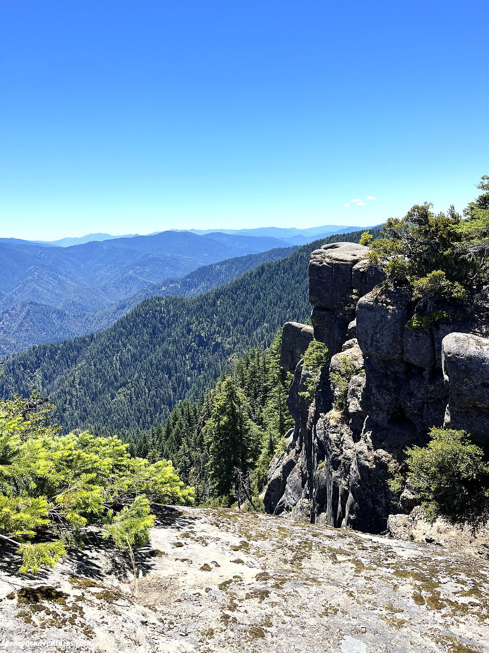
Hanging Rock is a prominent geological feature near the small town of Powers in southwestern Oregon. It rises sharply from the forest floor, creating a dramatic silhouette against the sky. The rock’s name comes from its distinctive shape, which appears to hang or jut out from the hillside.
The rock is part of the larger Rogue River-Siskiyou National Forest, an area known for its diverse ecosystems and outdoor recreation opportunities. Visitors to Hanging Rock can enjoy:
Scenic views of the surrounding forest and valleys
Varied hiking trails that range from easy walks to more challenging climbs
Wildlife sightings, including birds, deer, and other native animals
Peaceful natural settings away from crowded tourist spots
The combination of these features makes Hanging Rock a must-visit for those exploring Oregon’s natural beauty.

The trailhead from here is easy to spot. Hanging Rock is fully exposed to the elements, so check and know the weather forecast before going. You do not want to be out on the rock if it’s raining or icy because you risk slipping on slick rock. You also do not want to do this hike if there is a thunderstorm in the forecast because you will be exposed to being struck by lightning.

How to Get There
Reaching Hanging Rock is straightforward for travelers familiar with the Oregon coast and forest regions. Powers is located along Oregon Route 42, about 30 miles east of the coastal city of Coos Bay. From Powers, visitors can access local roads and trailheads leading to Hanging Rock.
Here are some tips for planning your trip:
Drive time: Powers is roughly a 2.5-hour drive from Eugene and about 3 hours from Portland.
Parking: There are small parking areas near trailheads, but spaces can fill up during peak seasons.
Best time to visit: Late spring through early fall offers the best weather for hiking and outdoor activities.
Bringing a map or GPS device is recommended, as cell service may be limited in some forest areas.


Hiking Trails Around Hanging Rock
Several trails provide access to Hanging Rock and the surrounding forest. These trails vary in length and difficulty, allowing visitors of all skill levels to enjoy the area.
Hanging Rock Trail
This is the most direct route to the rock itself. The trail is about 1.5 miles round trip and includes some moderate elevation gain. Along the way, hikers pass through dense forest and open clearings, with chances to spot local wildlife.
Powers Creek Loop
For those looking for a longer hike, the Powers Creek Loop offers a 5-mile circuit that passes near Hanging Rock. This trail features creek crossings, wildflower meadows, and panoramic views from higher points.
Connecting Trails
Several smaller paths connect Hanging Rock to other parts of the Rogue River-Siskiyou National Forest. These trails allow for extended hikes or multi-day backpacking trips for more adventurous visitors.


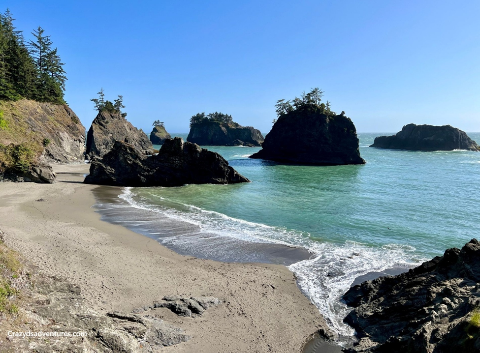
The further you go, the more views you have before you get to Hanging Rock.


If you love wildflowers as I do, this is also a great place to see them. Here are a couple of random pictures I took along the hike.


What to Bring for Your Visit
Preparing properly will help you enjoy your time at Hanging Rock safely and comfortably. Here are some essentials to pack:
Sturdy hiking shoes for uneven terrain
Water and snacks to stay hydrated and energized
Weather-appropriate clothing, including layers and rain gear
Map or GPS device for navigation
A camera or a smartphone to capture the stunning views
Binoculars for birdwatching and wildlife observation
Visitors should also follow Leave No Trace principles to protect the natural environment.


Wildlife and Plant Life
The area around Hanging Rock supports a wide variety of plants and animals. The forest includes Douglas fir, cedar, and pine trees, along with ferns and wildflowers that bloom in the warmer months.
Wildlife commonly seen includes:
Black-tailed deer
Various bird species, such as woodpeckers and hawks
Small mammals like squirrels and rabbits
Observing these creatures in their natural habitat adds to the experience of visiting Hanging Rock.

Tips for a Safe and Enjoyable Visit
To make the most of your visit to Hanging Rock, keep these tips in mind:
Check weather conditions before heading out
Stay on marked trails to avoid getting lost
Carry enough water, especially in warmer months
Respect wildlife by observing from a distance
Pack out all trash to keep the area clean
Following these guidelines helps preserve Hanging Rock’s beauty for future visitors.
NOTE:
This is a popular trail for birding, hiking, and walking, but you can still enjoy solitude during quieter times.
Dogs are welcome but must be on a leash.
As I mentioned earlier, download directions before you come.
Bring water. There is none on the hike.
Carry out what you carry in.
This is Black Bear and Cougar territory.
If you choose to do this hike at sunrise or sunset, bring a headlamp with at least 400 lumens. Anything lower will not be enough to illuminate the trail correctly.
Always let someone know where you are
Nearby Attractions and Activities
While Hanging Rock is a highlight, the Powers area offers other attractions worth exploring:
Rogue River: Known for fishing, rafting, and scenic beauty
Dean Creek Elk Viewing Area: A short drive away, this spot allows visitors to see elk herds up close
Local parks and picnic areas: Great for family outings and relaxing after a hike
Exploring these nearby sites can round out a day or weekend trip to the region.
Reflecting on the Hike
Visiting Hanging Rock in Powers, Oregon, is a journey into rugged beauty and quiet reflection. The dramatic cliffside views, the surrounding forest, and the sense of remoteness make it a destination that feels both wild and intimate. It’s a place where nature speaks loudly through its landscape,s yet offers visitors the calm of solitude.
Scenic drama: The rock’s imposing presence and panoramic views capture the raw spirit of Oregon’s wilderness.
Peaceful escape: Away from crowds, it’s ideal for those seeking quiet moments in nature.
Lasting impression: The combination of striking geology and serene atmosphere leaves visitors with a memory that lingers long after the hike ends.
Ultimately, Hanging Rock is more than a viewpoint—it’s a reminder of the power and simplicity of nature, offering both adventure and tranquility in equal measure.
Because of the scams going on with Airbnb and Vbro, I will not recommend places listed here on my blog. Here is a link to a couple of cases if you would like to read them.
Places To Stay:
You can show your appreciation with a virtual coffee if you have found value in my blog.

Do not forget to subscribe to get my monthly newsletter.
Some of the links found on my website are affiliate links. I earn from qualifying purchases as an Amazon Associate and an Expedia Associate. Through other links, I may also receive a small commission at no extra cost to you. Using them is a way to support me, help offset the cost of running this website, and ensure I can continue providing free content and resources.
I truly appreciate the support!


Comments