


Discovering Hidden Gems: Unique Hiking Trails Across the United States

If you enjoy this blog post, consider subscribing to get my newsletter.
Comments are always welcome and appreciated.
Hiking offers a chance to escape the ordinary and explore nature’s wonders. While popular trails attract many visitors, the United States holds countless lesser-known paths that reveal stunning landscapes and unique experiences. These hidden gems provide solitude, adventure, and a fresh perspective on the country’s diverse terrain. This guide highlights some of the most unique hiking trails across the U.S., perfect for those seeking something different from the usual routes.
Exploring Unique Hiking Trails Across the United States
The Pacific Northwest’s Secret Trails
The Pacific Northwest is famous for its lush forests and dramatic coastlines, but beyond the well-trodden paths lie trails that few hikers know about. The Enchantments in Washington State offer one of the most stunning and challenging alpine experiences in the United States. Nestled within the Alpine Lakes Wilderness, this area draws hikers, climbers, and nature lovers who seek pristine beauty and rugged terrain. This guide will help you understand what makes the Enchantments special, how to prepare for a visit, and what to expect on your journey.

What Makes the Enchantments Unique
The Enchantments are a series of high alpine lakes, granite peaks, and meadows that create a breathtaking landscape. The area is known for its:
Crystal-clear lakes surrounded by towering granite walls
Diverse wildlife, including mountain goats and marmots
Alpine meadows filled with wildflowers during summer
Challenging hiking trails that reward visitors with panoramic views
This combination of natural features creates an environment that feels remote and untouched, making it a favorite destination for outdoor enthusiasts.
Planning Your Trip to the Enchantments
Visiting the Enchantments requires careful planning due to its popularity and protected status. Here are key points to consider:
Permits and Regulations
The Enchantments are part of a wilderness area with strict permit requirements to preserve the environment. You need a permit for overnight stays between May and October. The lottery system distributes them due to high demand. Day hikes do not require permits but still require preparation.
Best Time to Visit
The prime hiking season runs from late June to early October. Snow usually melts by mid-July, opening most trails. Early summer may still have snow patches, while fall offers cooler temperatures and fewer crowds.
Physical Preparation
The Enchantments trails are strenuous, with significant elevation gain. Hikers should be in good physical condition and prepared for:
Steep climbs and descents
Rocky and uneven terrain
Variable weather conditions, including sudden storms
Popular Routes and Highlights
Several routes lead through the Enchantments, each offering unique views and experiences.
The Core Enchantment Zone
This is the heart of the area, featuring iconic spots like:
Colchuck Lake: A stunning turquoise lake at the base of Dragontail Peak
Lakes like Perfection, Inspiration, and Isolation: Each offers crystal-clear water and dramatic mountain backdrops
Aasgard Pass: A steep and challenging climb that rewards hikers with access to the Core Zone
Snow Lakes Trail
For those looking for a less crowded option, the Snow Lakes Trail offers beautiful alpine scenery with fewer hikers. It is a good choice for day trips or shorter overnight stays.
Stuart Lake and Mount Stuart
Mount Stuart is one of the region's tallest peaks. The trail to Stuart Lake offers excellent views and a chance to experience the rugged terrain without the extreme difficulty of climbing the peak.
Tips for a Safe and Responsible Visit
The Enchantments are a fragile environment. Visitors should follow Leave No Trace principles to minimize impact:
Pack out all trash and food waste
Camp only in designated areas
Avoid disturbing wildlife
Stay on established trails to prevent erosion
Weather can change rapidly, so always check forecasts and be prepared for cold, rain, or even snow at higher elevations.
What to Expect on the Trail
Hiking in the Enchantments is both physically demanding and visually rewarding. You will encounter:
Rocky switchbacks and steep ascents
Clear alpine lakes are perfect for rest stops
Expansive views of jagged peaks and valleys
Occasional wildlife sightings, including marmots and mountain goats
The experience is often described as transformative, offering a deep connection with nature and a sense of accomplishment.
Cape Falcon Trail, Oregon
The Cape Falcon Trail in Oregon offers one of the most rewarding hiking experiences along the Pacific Northwest coast. Stretching through lush forests and rugged cliffs, this trail reveals breathtaking views of the ocean and surrounding landscapes. Whether you are an avid hiker or a nature lover seeking a peaceful escape, the Cape Falcon Trail offers a memorable adventure filled with natural beauty and tranquility.

Where to Find Cape Falcon Trail
Located near the town of Manzanita on Oregon’s northern coast, Cape Falcon Trail is part of Oswald West State Park. This park is known for its dense forests, sandy beaches, and dramatic headlands. The trailhead is easily accessible from Highway 101, making it a convenient destination for day trips or weekend getaways.
What to Expect on the Trail
The Cape Falcon Trail spans approximately 5 miles round-trip, with moderate elevation changes that make it suitable for most hikers. The path winds through old-growth Sitka spruce and Douglas fir trees, offering shade and a cool atmosphere even on warmer days. Along the way, you will encounter several viewpoints that provide stunning panoramas of the Pacific Ocean and nearby coastal features.
Highlights Along the Trail
Cape Falcon Overlook: This is the trail’s main viewpoint, where you can see the rocky headland jutting into the ocean. On clear days, the view extends to Tillamook Head and beyond.
Wildlife Spotting: Keep an eye out for bald eagles, seabirds, and sometimes even seals or sea lions along the shore.
Flora and Fauna: The trail passes through diverse ecosystems, including coastal forests and meadows filled with wildflowers during spring and summer.
Best Time to Visit
Spring through early fall is the ideal time to hike the Cape Falcon Trail. During these months, the weather is generally mild, and the wildflowers are in bloom. Winter hikes are possible but bring more rain and slippery conditions. Summer offers longer daylight hours, perfect for extended exploration.
Nearby Attractions to Explore
After completing the trail, you might want to explore other nearby spots:
Manzanita Beach: A beautiful sandy beach perfect for relaxing or beachcombing.
Neahkahnie Mountain: For those seeking a more challenging hike with panoramic views.
Local dining: Manzanita has charming cafes and restaurants where you can enjoy fresh seafood and local fare.
Safety Considerations
While Cape Falcon Trail is generally safe, it’s important to be prepared:
Inform someone about your hiking plans.
Carry a map or use a GPS device.
Watch for slippery rocks near the ocean.
Be cautious of wildlife and keep a respectful distance.
Why Cape Falcon Trail Stands Out
Cape Falcon Trail stands out for its blend of coastal beauty and forest serenity. Unlike crowded tourist spots, this trail offers a quiet, immersive nature experience. The views from the headland are some of the most spectacular on the Oregon coast, rewarding hikers with a sense of accomplishment and awe.
Exploring the Cape Falcon Trail lets you connect with Oregon’s natural heritage and enjoy a peaceful retreat from everyday life. Whether you hike for exercise, photography, or to unwind, this trail provides a perfect setting.
Discovering the Southwest’s Unique Desert Paths
The Southwest offers stark beauty with its desert landscapes, red rock formations, and vast open spaces. Some trails stand out for their unusual features and solitude.
Wave Cave Trail, Arizona
Arizona offers some of the most unique and breathtaking hiking experiences in the United States. Among these, the Wave Cave Trail stands out for its striking rock formations and scenic views. This trail combines adventure with natural beauty, making it a must-visit for outdoor enthusiasts and photographers alike. If you want to explore a lesser-known gem that showcases Arizona’s rugged landscape, the Wave Cave Trail is an excellent choice.

What Makes Wave Cave Trail Special
Wave Cave Trail is located near the town of Page, Arizona, a gateway to many natural wonders. The trail is famous for its distinctive sandstone formations that resemble ocean waves frozen in stone. These formations create a surreal environment, like stepping into another world.
The trail is relatively short, about 2 miles round trip, but it offers a rewarding experience with its unique geological features. The highlight is the Wave Cave itself, a hollowed-out rock formation that looks like a giant wave curling over the desert floor. This natural sculpture is perfect for photography and exploration.
Planning Your Hike
Before heading out, prepare properly for the hike. Here are some tips to help you get the most out of your visit:
Best Time to Visit
The ideal time to hike the Wave Cave Trail is during the cooler months, from October to April. Summer temperatures in Arizona can soar above 100°F, making hiking uncomfortable and potentially dangerous.
What to Bring
Carry plenty of water, sunscreen, a hat, and sturdy hiking shoes. The trail is sandy and rocky, so good footwear will help you navigate the terrain safely. Hiking poles are also a good thing because of the snakes, tarantulas, and scorpions in the area. When you use the hiking pole, it sends a vibration when it strikes the ground, letting them know you are coming. Generally, they will move out of the way. Remember, I said, “GENERALLY”.”
Trail Difficulty
The trail is considered moderate because of uneven surfaces and slight elevation changes. It suits most hikers with a reasonable level of fitness.
Navigation
The trail isn't always clearly marked, so bring a GPS device or a detailed map. Cell phone service can be spotty in this area.
Highlights Along the Trail
As you hike, you’ll notice several features that make the Wave Cave Trail memorable:
Sandstone Waves
The undulating sandstone formations are the main attraction. Wind and water erosion have shaped these natural waves over millions of years.
Colorful Rock Layers
The rocks display a range of colors from deep reds to soft yellows, creating a vibrant palette that changes with the sunlight.
Desert Flora and Fauna
Keep an eye out for desert plants like cacti and wildflowers, as well as wildlife such as lizards and birds that inhabit the area.
Panoramic Views
From certain points on the trail, you can see sweeping views of the surrounding desert and distant mountains, offering excellent photo opportunities.
Nearby Attractions to Explore
If you have extra time, the area around Wave Cave Trail offers other attractions worth visiting:
Antelope Canyon
Famous for its narrow, winding sandstone walls and light beams, Antelope Canyon is a photographer’s dream.
Horseshoe Bend
A dramatic bend in the Colorado River that provides stunning views and is just a short drive from the trail.
Lake Powell
A large reservoir offering boating, fishing, and swimming opportunities.
Final Thoughts on Wave Cave Trail
Wave Cave Trail offers a unique hiking experience that combines natural artistry with the rugged beauty of Arizona’s desert. Its distinctive sandstone waves and colorful rock layers create a landscape unlike any other. Whether you are an avid hiker, a nature lover, or a photographer, this trail provides a memorable adventure.
Plan your visit for the cooler months, pack the right gear, and take time to appreciate the stunning scenery. Exploring the Wave Cave Trail will leave you with a deeper appreciation for the natural forces that shape our planet and a collection of unforgettable memories.
Lost Coast Trail, California
The Lost Coast Trail in California offers one of the most rugged and remote hiking experiences on the West Coast. Unlike many popular trails, this path remains largely untouched by development, providing a raw connection to nature that few places can match. For hikers seeking solitude, dramatic coastal views, and a challenge, the Lost Coast Trail delivers all this and more.
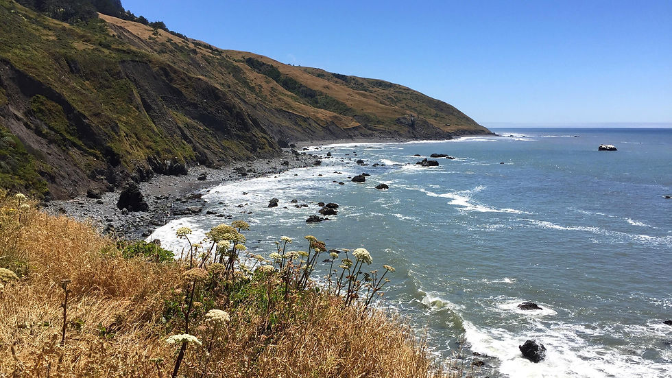
What Makes the Lost Coast Trail Unique
The Lost Coast Trail stretches about 25 miles along California’s northern coastline, from Mattole Beach near Petrolia to Black Sands Beach near Shelter Cove. This section of coastline earned its name because it was too difficult for highway builders to develop, leaving it isolated and wild.
The trail passes through sandy beaches, rocky headlands, tide pools, and dense forests. Hikers can expect to see towering cliffs, sea stacks, and abundant wildlife, including seals, seabirds, and sometimes even whales offshore. The trail’s remoteness means you’ll likely encounter few other people, making it a peaceful escape from crowded parks.
Planning Your Hike on the Lost Coast Trail
Preparation is key to a successful Lost Coast Trail trip. The terrain is challenging, and the trail crosses several tidal zones, so timing your hike with the tides is essential to avoid dangerous water levels.
Permits: You need a permit to camp along the trail. These are limited and can be reserved through the Bureau of Land Management (BLM) website.
Tide Tables: Check tide schedules carefully. Some sections are only passable at low tide.
Gear: Bring sturdy hiking boots, a good backpack, and camping gear suitable for coastal weather, which can be cool and wet even in summer.
Water: Carry enough water or have a reliable way to purify natural sources.
Navigation: The trail is marked but can be confusing in some areas. A map and compass or GPS device is recommended.
Highlights Along the Trail
Several spots along the Lost Coast Trail stand out for their natural beauty and unique features:
Mattole Beach: The trailhead offers a wide sandy beach with views of offshore rocks and crashing waves.
Black Sands Beach: Known for its dark volcanic sand, it’s a great place to rest and enjoy the ocean.
Tide Pools: Explore tide pools filled with starfish, anemones, and crabs during low tide.
Dense Forests: Inland sections feature towering Sitka spruce and redwoods, contrasting with the open coastline.
Wildlife Viewing: Keep an eye out for harbor seals resting on rocks and seabirds nesting on cliffs.
Why Choose the Lost Coast Trail
For those who want to experience California’s coastline without crowds or commercial development, the Lost Coast Trail is a rare gem. It offers a mix of adventure, solitude, and stunning scenery that few other trails can match. Whether you are an experienced backpacker or a nature lover seeking a unique challenge, this trail rewards effort with unforgettable views and a deep connection to the wild Pacific coast.
The trail’s ruggedness and isolation mean it suits hikers who are prepared and confident in backcountry skills. But for those who take on the challenge, the Lost Coast Trail offers a journey through some of the most pristine and dramatic coastal landscapes in the United States.
Chisos Basin Loop, Texas
The Chisos Basin Loop offers one of Texas's most captivating hiking experiences. Nestled within Big Bend National Park, this trail showcases dramatic mountain views, diverse wildlife, and unique desert flora. For outdoor enthusiasts and nature lovers, the Chisos Basin Loop provides a perfect blend of challenge and beauty, making it a must-visit destination.
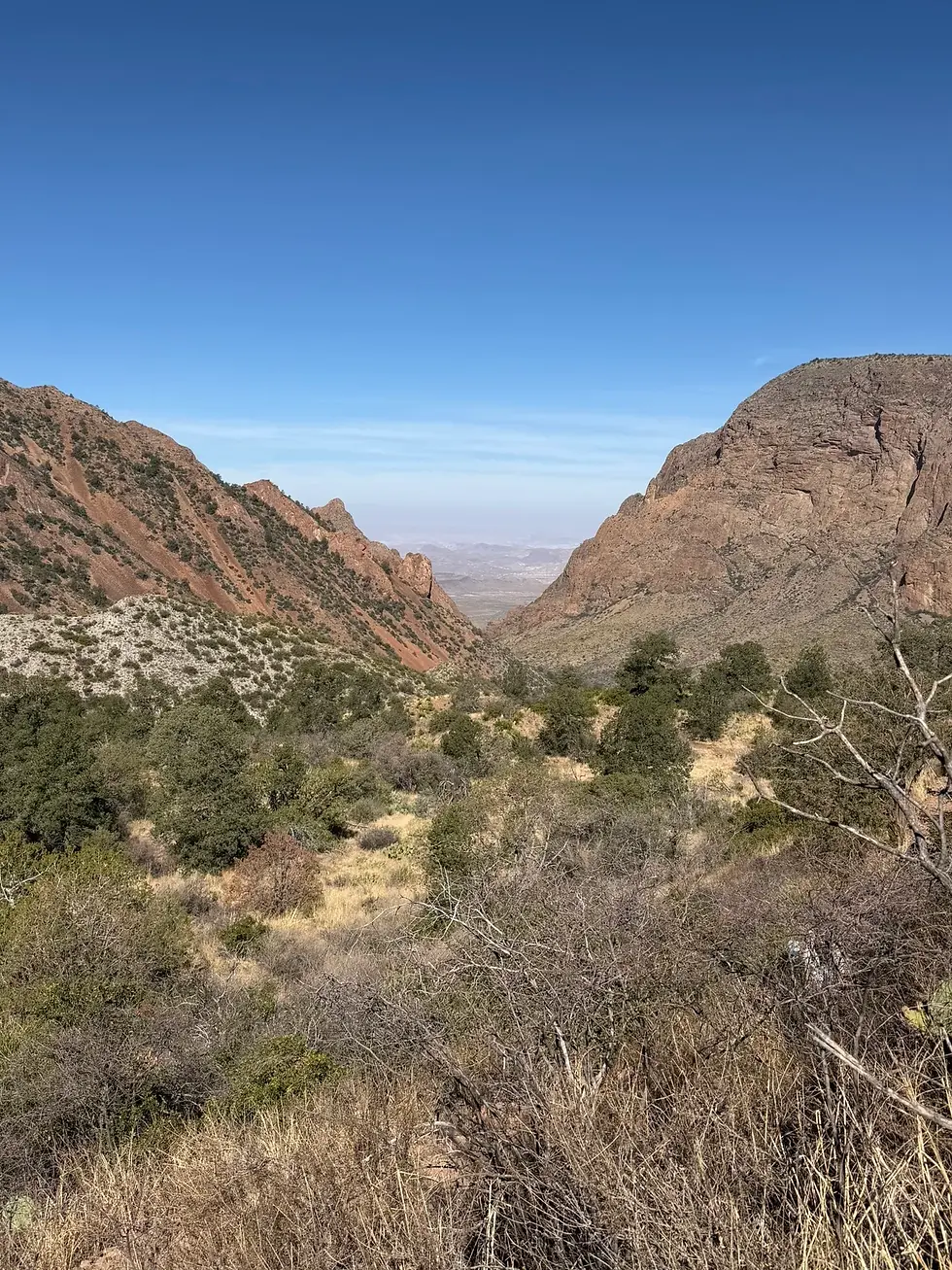
What Makes the Chisos Basin Loop Special
The Chisos Basin Loop is a roughly 7.5-mile trail that circles the heart of the Chisos Mountains. Unlike many Texas hikes that stay at lower elevations, this loop climbs through pine forests, rocky ridges, and open meadows. The elevation gain is moderate, around 1,500 feet, which means hikers get rewarding panoramic views without extreme difficulty.
The trail passes through several distinct environments:
Pine and oak woodlands: Cooler and shaded areas with tall trees and occasional wildlife sightings.
Rocky outcrops: Exposed ridges offering sweeping views of the surrounding desert and mountains.
Wildflower meadows: Seasonal bursts of color that add vibrancy to the landscape.
This variety keeps the hike engaging and offers plenty of photo opportunities.
Planning Your Hike on the Chisos Basin Loop
Before you set out, prepare properly for the Chisos Basin Loop. Here are some practical tips:
Start early: Temperatures can rise quickly, especially in summer. Early morning hikes help avoid the heat.
Bring plenty of water: The dry climate means dehydration is a real risk. Carry at least two liters per person.
Wear sturdy shoes: The trail includes rocky sections and uneven terrain.
Check the weather: Sudden storms can occur, so be ready to turn back if conditions worsen.
Pack layers: Higher elevations can be cooler, even in warm months.
The trailhead is located near the Chisos Basin Visitor Center, where you can get maps and current trail conditions.
Highlights Along the Trail
Several spots along the Chisos Basin Loop stand out for their natural beauty and unique features.
The Window Viewpoint
One of the loop's most famous sights is The Window, a natural rock formation that frames a distant desert valley. From this vantage point, hikers can see the vast expanse of the Chihuahuan Desert stretching out below the mountains. The contrast between the green basin and the arid desert beyond is striking.
Emory Peak
Though the loop itself does not summit Emory Peak, the highest point in Big Bend National Park, it passes close enough for a side trip. Emory Peak rises to 7,825 feet and offers some of the park's best views. For those with extra energy, the short detour to the peak summit is well worth the effort.
Wildlife Watching
The Chisos Basin is home to a variety of animals, including mule deer, black bears, and numerous bird species. Early-morning or late-afternoon hikes increase the chance of spotting wildlife. Keep a respectful distance and avoid feeding animals.
What to Expect on the Trail
The Chisos Basin Loop is well-marked and maintained, but hikers should be prepared for some rugged sections. The trail surface varies from packed dirt to loose rocks. Elevation changes are steady but manageable for most people with moderate fitness.
Along the way, you will find benches and shaded spots perfect for resting and enjoying the scenery. The trail is popular but not usually crowded, allowing for a peaceful experience.
Nearby Attractions to Explore
After completing the loop, consider visiting other parts of Big Bend National Park:
Hot Springs Historic Area: Relax in natural hot springs along the Rio Grande.
Santa Elena Canyon: A dramatic river gorge with easy hiking trails.
Fossil Discovery Exhibit: Learn about the park’s ancient past.
These sites add depth to your visit and showcase the park’s diverse offerings.
Final Thoughts on the Chisos Basin Loop
The Chisos Basin Loop stands out as a rewarding hike that captures the essence of Big Bend National Park. It combines scenic mountain landscapes, wildlife encounters, and a manageable challenge for most hikers. Whether you are a seasoned trekker or a casual nature lover, this trail offers a memorable outdoor adventure.
Hidden Trails in the Northeast’s Forests and Mountains
The Northeast is often associated with crowded trails, but it also has quiet paths that reveal its rich natural heritage.
The Pinnacle, New York
New York is famous for its cityscape, but beyond the skyscrapers lies a world of natural beauty waiting to be explored. One of the state’s lesser-known treasures is The Pinnacle, a hiking destination that offers stunning views, diverse terrain, and a rewarding outdoor experience. For hikers looking to escape the crowds and discover a unique trail, The Pinnacle stands out as a perfect choice.

Where to Find The Pinnacle
The Pinnacle is located in the Hudson Highlands, part of the larger Hudson Highlands State Park Preserve. This area is about an hour north of New York City, making it accessible for a day trip or a weekend getaway. The trailhead is near the small town of Cold Spring, a charming village known for its antique shops and riverside dining.
Getting to The Pinnacle is straightforward. From Cold Spring, you can park near the well-marked, well-maintained trail entrance. Public transportation options include a Metro-North train to Cold Spring, followed by a short walk to the trailhead.
What to Expect on the Trail
The hike to The Pinnacle is roughly 2.5 miles one way, with an elevation gain of about 900 feet. The trail is moderately challenging, suitable for hikers with some experience, but manageable for prepared beginners. The path winds through mixed hardwood forests, rocky outcrops, and open ledges.
Along the way, hikers will encounter:
Shaded forest sections with a variety of trees, including oak, maple, and birch.
Rocky scrambles that require careful footing but add excitement to the journey.
Wildlife sightings, including birds, squirrels, and occasionally deer.
Seasonal wildflowers in spring and summer add bursts of color.
The trail is well-marked with blazes and signs, making navigation simple. Bring a map or use a GPS app, especially if you plan to explore connecting trails in the area.
The Rewarding View from The Pinnacle
The hike's highlight is the summit itself. The Pinnacle offers panoramic views of the Hudson River, the surrounding highlands, and, on clear days, the distant New York City skyline. The vantage point is perfect for resting, taking photos, or enjoying a packed lunch.
The rocky ledges provide plenty of space to sit and soak in the scenery. The view changes with the seasons: vibrant greens in summer, fiery reds and oranges in fall, and a crisp, clear landscape in winter.
Exploring Nearby Attractions
After your hike, take some time to explore Cold Spring. The town offers cozy cafes, local shops, and riverfront parks. You might also consider visiting nearby hiking spots like Breakneck Ridge or Bull Hill for more adventure.
For history buffs, the Hudson Highlands are rich with Revolutionary War sites and old forts. Combining hiking with a bit of local history makes for a well-rounded day trip.
Why The Pinnacle Stands Out
The Pinnacle stands out for its balance of accessibility and natural beauty. It’s close enough to a major city for convenience but remote enough to feel like a true escape. The trail offers enough challenge to satisfy active hikers without being overwhelming.
The views from the top are among the best in the Hudson Valley, offering a fresh perspective on the region’s landscape. Whether you are a local or visiting from afar, The Pinnacle offers a memorable outdoor experience.
Green Mountains Long Trail, Vermont
The Green Mountains Long Trail in Vermont offers one of the most rewarding hiking experiences in the northeastern United States. Stretching over 270 miles from the Massachusetts border to the Canadian border, this trail invites adventurers to explore dense forests, rugged peaks, and peaceful valleys. Whether you are a seasoned backpacker or a casual day hiker, the Long Trail presents a unique opportunity to connect with nature and discover Vermont’s stunning mountain landscape.

History and Significance of the Long Trail
The Green Mountains Long Trail is the oldest long-distance hiking trail in the United States, established in 1910 by the Green Mountain Club. Its creation aimed to protect the natural beauty of Vermont’s mountains and provide a continuous path for outdoor enthusiasts. The trail follows the main ridge of the Green Mountains, passing through several state parks and wilderness areas.
This trail is not only a physical challenge but also a cultural and environmental treasure. It showcases Vermont’s commitment to conservation and outdoor recreation. Hikers can experience a variety of ecosystems, from hardwood forests to alpine zones, and witness the changing seasons in a way few other places offer.
Planning Your Hike on the Long Trail
Before setting out on the Green Mountains Long Trail, preparation is key. The trail’s length and terrain require careful planning to stay safe and enjoy the trip.
Choose Your Section: While some hikers attempt the entire trail, many prefer to explore shorter sections. Popular segments include the stretch around Mount Mansfield, Vermont’s highest peak, and the area near Camel’s Hump, known for its distinctive shape and panoramic views.
Check Trail Conditions: Mountain weather can change quickly. Spring and fall offer cooler temperatures but may bring mud or early snow. Summer is warmer but can be crowded. Winter hiking requires specialized gear and experience.
Pack Essentials: Bring sturdy hiking boots, layered clothing, a map or GPS device, plenty of water, and food. A first aid kit and emergency supplies are also important.
Permits and Regulations: The Long Trail itself does not require permits, but some state parks along the route may have specific rules. Always follow Leave No Trace principles to protect the environment.
What to Expect on the Trail
The Green Mountains Long Trail offers a variety of landscapes and challenges. Hikers will encounter:
Steep Ascents and Descents: The trail crosses many peaks, including Mount Mansfield (4,393 feet) and Killington Peak (4,229 feet). These climbs can be strenuous but reward hikers with breathtaking views.
Diverse Flora and Fauna: The trail passes through mixed hardwood forests, spruce-fir zones, and alpine meadows. Wildlife such as black bears, moose, and various bird species inhabit these areas.
Shelters and Campsites: The Green Mountain Club maintains numerous shelters and campsites along the trail. These provide safe places to rest and connect with fellow hikers.
Scenic Vistas: Lookouts along the trail offer sweeping views of Vermont’s valleys, lakes, and distant mountains. The summit of Camel’s Hump is especially famous for its panoramic scenery.
Nearby Attractions and Activities
Exploring the Green Mountains Long Trail also opens the door to other Vermont attractions:
Stowe: This charming town near Mount Mansfield offers dining, lodging, and outdoor activities like mountain biking and skiing.
Smugglers’ Notch State Park: Known for its dramatic cliffs and rock formations, this park is a great spot for climbing and exploring.
Lake Champlain: Located west of the Green Mountains, this large lake provides opportunities for boating, fishing, and relaxing by the water.
Local Farms and Markets: Vermont is famous for its farm-to-table culture. Stop by roadside stands or farmers’ markets for fresh produce and artisanal goods.
Preparing for Multi-Day Hikes
For those interested in thru-hiking or multi-day trips, the Long Trail requires additional preparation:
Plan Your Itinerary: Map out daily distances and overnight stops. Shelters are spaced roughly 6 to 12 miles apart.
Pack Light but Smart: Carry only essentials to reduce weight but ensure you have shelter, food, and safety gear.
Physical Conditioning: Build endurance through regular hiking and strength training before tackling long sections.
Navigation Skills: Even with marked trails, bring a map, compass, or GPS. Cell service can be unreliable.
Emergency Plan: Share your itinerary with someone and know trailhead locations and emergency contacts.
The Experience of Hiking the Green Mountains Long Trail
Walking the Long Trail offers more than just physical exercise. It provides a chance to disconnect from daily life and immerse yourself in nature’s rhythms. Many hikers describe a sense of peace and accomplishment as they traverse the rugged terrain and witness the changing landscapes.
The trail fosters a sense of community among hikers. Sharing stories at shelters, helping others on difficult sections, and celebrating milestones create lasting memories. The Long Trail is a journey of discovery, resilience, and connection.
Mount Greylock’s Hidden Loop, Massachusetts
Mount Greylock, Massachusetts' highest peak, draws hikers and nature lovers from across the region. While many visitors stick to the well-known trails, a lesser-known path called the Hidden Loop offers a unique experience. This trail combines solitude, scenic views, and a touch of mystery, making it a must-explore for those seeking something beyond the usual routes.

What Makes the Hidden Loop Special
The Hidden Loop is tucked away on the western side of Mount Greylock. Unlike the crowded summit trails, this loop offers a quieter, more intimate encounter with the mountain’s natural beauty. The trail winds through dense forests, crosses babbling streams, and reveals unexpected clearings with panoramic views.
Hikers often mention the sense of discovery they feel here. The trail is less marked than others, encouraging careful navigation and rewarding those who pay close attention to the surroundings. This makes the Hidden Loop ideal for experienced hikers who enjoy a bit of challenge and exploration.
Planning Your Hike on the Hidden Loop
Before you set out, prepare properly. The Hidden Loop is about 5 miles long and typically takes 3 to 4 hours to complete, depending on your pace and stops. Here are some tips to help you get ready:
Bring a detailed map or GPS device. The trail markers can be sparse, so navigation tools are essential.
Wear sturdy hiking boots. The terrain includes rocky sections and uneven ground.
Pack water and snacks. No facilities are available along the loop.
Start early in the day. This allows time to enjoy the hike without rushing.
Check the weather forecast. Conditions can change quickly on the mountain.
The trailhead for the Hidden Loop is accessible from the western parking area near Lanesborough. From there, the path leads into a quiet forest that feels miles away from civilization.
Highlights Along the Hidden Loop
Several features make this trail stand out:
Old Growth Forest: Parts of the loop pass through some of Mount Greylock's oldest trees. Towering pines and hardwoods create a peaceful canopy.
Hidden Waterfalls: Small waterfalls and cascades appear unexpectedly along the route, perfect spots to rest or take photos.
Lookout Points: The loop includes several clearings with views of the Taconic Mountains and the Berkshires. These spots are less crowded than the summit overlooks.
Wildlife Sightings: Deer, foxes, and a variety of birds are often seen along the trail, adding to the sense of wilderness.
These features combine to make the Hidden Loop a rewarding hike that feels like a secret shared only with those who venture off the beaten path.
Tips for a Safe and Enjoyable Experience
While the Hidden Loop is accessible to most hikers in good shape, it demands respect for the environment and awareness of safety:
Stay on the trail. This protects fragile plants and prevents erosion.
Carry a first aid kit. Minor injuries can happen on rocky or slippery sections.
Leave no trace. Pack out all trash and avoid disturbing wildlife.
Tell someone your plans. Cell service can be spotty on the mountain.
Be prepared for changing weather. Layers and rain gear can make a big difference.
Following these guidelines helps preserve the trail’s beauty and ensures a positive experience for everyone.
Why Explore the Hidden Loop
Many hikers visit Mount Greylock for the summit views and popular trails. The Hidden Loop offers a different kind of adventure. It invites you to slow down, notice small details, and enjoy the mountain’s quieter side. If you want to escape crowds and find a trail that feels like a personal discovery, this loop is worth the effort.
Exploring this trail also connects you to the area’s history. Mount Greylock has inspired writers and artists for centuries, including Herman Melville and William Cullen Bryant. Walking the Hidden Loop, you follow in the footsteps of those who found inspiration in these woods and hills.
Getting There and Nearby Attractions
Mount Greylock is located in the northwest corner of Massachusetts, near the towns of Lanesborough and Adams. The Hidden Loop trailhead is best reached by car, with parking available at the western access point.
After your hike, consider visiting:
Mount Greylock State Reservation Visitor Center: Learn about the mountain’s natural and cultural history.
Bascom Lodge: A historic lodge near the summit offering food and rest.
Local towns: Lanesborough and Adams have charming shops and restaurants to explore.
These options make a day trip or weekend getaway easy and enjoyable.
Unique Trails in the Southeast’s Diverse Landscapes
The Southeast features a mix of mountains, wetlands, and coastal areas. Some trails stand out for their unusual ecosystems and peaceful settings.
Blackwater River State Forest, Florida
Blackwater River State Forest in Florida offers more than just a typical outdoor experience. This vast forest, spanning over 200,000 acres, holds a variety of natural treasures waiting to be discovered. From pristine waterways to diverse wildlife and quiet trails, it provides a perfect escape for nature lovers and adventure seekers alike. This post explores some of the lesser-known highlights of Blackwater River State Forest and offers practical tips for making the most of your visit.

Discovering the Scenic Waterways
One of the most captivating features of Blackwater River State Forest is its network of clear, winding rivers and streams. The Blackwater River itself is famous for its crystal-clear water and sandy bottom, making it ideal for canoeing and kayaking. Unlike many Florida rivers, the Blackwater River flows swiftly and offers gentle rapids, adding excitement for paddlers of all skill levels.
Visitors can launch their boats at several access points, including the Munson Highway launch and the Deer Park area. These spots provide easy entry and parking, making it convenient to explore the river’s calm stretches and occasional whitewater sections. Along the riverbanks, you might spot turtles basking on logs or herons hunting for fish.
For those who prefer to stay on land, the forest features several hiking trails that run parallel to the waterways. These trails offer peaceful river views and opportunities to observe local flora and fauna.
Exploring Diverse Hiking Trails
Blackwater River State Forest has over 50 miles of hiking trails, ranging from easy walks to more challenging routes. One standout trail is the Pine Log State Forest Trail, which winds through pine flatwoods and hardwood swamps. This trail is perfect for birdwatchers, as it passes through habitats favored by species like the red-cockaded woodpecker and the barred owl.
Another popular option is the Blackwater Heritage Trail, a multi-use trail open to hikers, mountain bikers, and horseback riders. This trail showcases the forest’s varied ecosystems, including longleaf pine forests and cypress swamps. Along the way, interpretive signs provide insights into the forest’s history and ecology.
When planning your hike, bring plenty of water, insect repellent, and sturdy footwear. The forest can be hot and humid, especially in summer, and some trails may have uneven terrain.
Wildlife Watching Opportunities
The forest is home to a wide variety of wildlife, making it a great destination for animal enthusiasts. White-tailed deer, wild turkeys, and raccoons are common sights. Birdwatchers will appreciate the chance to see species like the pileated woodpecker, eastern bluebird, and various warblers.
Early-morning or late-afternoon visits increase the chances of spotting animals, as many species are more active during these cooler parts of the day. Bring binoculars and a camera with a zoom lens to capture distant wildlife without disturbing them.
The forest also supports several rare and protected species. For example, the gopher tortoise, a keystone species in Florida’s ecosystems, can be found in sandy upland areas. Observing these creatures in their natural habitat offers a unique glimpse into the forest’s ecological balance.
Camping and Overnight Stays
For those wanting to extend their visit, Blackwater River State Forest offers several camping options. Deer Park Campground is a popular choice, with shaded sites, picnic tables, and fire rings. This campground provides a rustic experience close to the river, perfect for fishing, swimming, or simply relaxing by the water.
Backcountry camping is also allowed in designated areas for visitors seeking solitude and a deeper connection with nature. When camping in the forest, follow Leave No Trace principles to protect the environment and wildlife.
Reservations are recommended during peak seasons, especially on weekends and holidays. Check the Florida Forest Service website for up-to-date information on camping fees and regulations.
Ozark Highlands Trail, Arkansas
The Ozark Highlands Trail offers one of Arkansas's most rewarding hiking experiences. Stretching over 165 miles through the rugged terrain of the Ozark National Forest, this trail invites outdoor enthusiasts to explore dense forests, rocky bluffs, and peaceful streams. Whether you are an experienced backpacker or a casual day hiker, the Ozark Highlands Trail offers a unique and memorable way to connect with nature.

What Makes the Ozark Highlands Trail Special
The trail winds through the heart of the Ozark Mountains, showcasing a variety of landscapes that change with the seasons. Hikers can expect to see towering hardwood trees, deep valleys, and panoramic views from high ridges. Dedicated volunteers maintain the trail, ensuring a safe and enjoyable journey.
One of the trail’s highlights is its diverse wildlife. Visitors often spot deer, wild turkeys, and a variety of songbirds. The area is also home to several rare plant species, making it a great destination for nature lovers interested in botany.
Highlights Along the Trail
Several spots along the Ozark Highlands Trail stand out for their natural beauty and unique features:
Hawksbill Crag, also known as Whitaker Point, is an iconic rock formation offering breathtaking views over the forested valleys below. It’s a popular photo spot and a must-see for hikers.
Buffalo River Overlook: This area provides stunning vistas of the Buffalo National River, one of the first national rivers in the United States.
Horsehead Canyon: A peaceful section with a small waterfall and quiet pools, perfect for a rest or picnic.
Richland Creek Wilderness: A remote area with rugged terrain and pristine streams, ideal for those seeking solitude.
When to Visit the Ozark Highlands Trail
The trail is accessible year-round, but spring and fall are the best times to visit. Spring brings wildflowers and fresh greenery, while fall offers vibrant foliage and cooler temperatures. Summer can be hot and humid, so early morning hikes are recommended. Winter hikes are possible but require extra preparation for cold weather and shorter daylight hours.
Getting There and Nearby Amenities
The Ozark Highlands Trail is located in northern Arkansas, with several access points near towns like Jasper and Ponca. These towns offer lodging, dining, and outdoor gear shops. Visitors can also find campgrounds along the trail for overnight stays.
Public transportation options are limited, so most hikers arrive by car. Parking is available at trailheads, but spaces can fill quickly during peak seasons.
Embracing the Experience
Hiking the Ozark Highlands Trail is more than just a physical challenge. It’s an opportunity to disconnect from daily life and immerse yourself in the quiet beauty of the Ozarks. The trail’s combination of scenic views, diverse ecosystems, and peaceful solitude makes it a destination worth exploring.
Whether you plan a short day hike or a multi-day backpacking trip, the Ozark Highlands Trail offers a rewarding adventure that showcases Arkansas’s natural charm.
Linville Gorge, North Carolina
Nestled in the heart of the Blue Ridge Mountains, Linville Gorge offers one of North Carolina's most rugged and breathtaking natural experiences. Known as the “Grand Canyon of the East,” this wilderness area captivates visitors with its cliffs, dense forests, and the roaring Linville River carving through the valley below. For those seeking adventure, solitude, or a deep connection with nature, Linville Gorge presents a unique destination that remains largely untouched by crowds.

The Rugged Terrain and Scenic Beauty
Linville Gorge spans roughly 12,000 acres of wilderness, featuring dramatic elevation changes that create a challenging yet rewarding landscape. The gorge plunges nearly 1,400 feet from the rim to the river, offering spectacular views from various overlooks. The cliffs and rocky outcrops contrast sharply with the lush greenery of the surrounding forest.
Visitors can explore numerous hiking trails that wind through the gorge, ranging from moderate to strenuous. The Linville Gorge Trail is a favorite among experienced hikers, stretching about 11 miles along the rim and offering panoramic views of the canyon below. Along the way, hikers encounter diverse plant life, including rhododendrons, mountain laurels, and towering hardwoods.
Hiking and Outdoor Activities
Hiking is the primary activity in Linville Gorge, but the area also supports rock climbing, fishing, and camping. The rugged cliffs attract climbers looking for challenging routes with rewarding vistas. The Linville River, known for its clear waters and trout population, offers excellent fishing opportunities for anglers.
Camping within the gorge is primitive and requires preparation. No developed campgrounds exist, so visitors must follow Leave No Trace principles and be self-sufficient. Backcountry camping allows for an immersive experience, surrounded by the sounds of rushing water and wildlife.
Wildlife and Plant Life
Linville Gorge is home to a variety of wildlife species, including black bears, white-tailed deer, wild turkeys, and numerous bird species. Birdwatchers can spot peregrine falcons nesting on the cliffs, a rare sight in the eastern United States. The dense forests provide habitat for salamanders, small mammals, and a rich diversity of insects.
The plant life in the gorge is equally impressive. The mix of hardwoods and evergreens creates a vibrant ecosystem that changes with the seasons. Spring brings wildflowers like trilliums and violets, while autumn transforms the foliage into a tapestry of reds, oranges, and yellows.
Getting There and Accessibility
Linville Gorge is located near the town of Morganton, North Carolina. Access points include the Linville Falls Visitor Center and various trailheads along Forest Service roads. While the area is remote, you can reach it by car, with parking available at designated spots.
Linville Gorge's wilderness character means it isn't suitable for those seeking paved paths or easy access. Visitors should be prepared for backcountry conditions and limited facilities.
Why Linville Gorge Stands Out
Unlike many popular parks, Linville Gorge remains a true wilderness area. Its ruggedness discourages large crowds, allowing visitors to experience solitude and a deep connection with nature. The combination of cliffs, diverse ecosystems, and the powerful river below creates a dramatic setting that feels far removed from everyday life.
For outdoor enthusiasts who appreciate challenge and beauty, Linville Gorge offers a rewarding escape. Whether hiking along the rim, fishing in the river, or simply soaking in the views, visitors leave with a lasting impression of this hidden gem in North Carolina.
Exploring the Midwest’s Lesser-Known Natural Trails
The Midwest is often overlooked for hiking, but it has unique trails that showcase its prairies, forests, and river valleys.
Ice Age Trail, Wisconsin
The Ice Age Trail in Wisconsin offers a unique way to experience the state’s natural history and stunning landscapes. Stretching over 1,000 miles, this trail traces the edge of the last continental glacier that shaped much of the region’s terrain. For hikers, nature lovers, and outdoor enthusiasts, the Ice Age Trail presents a chance to walk through time while enjoying diverse ecosystems and breathtaking views.

Discovering the Trail’s Geological Story
The Ice Age Trail follows the path glaciers left behind as they retreated around 12,000 years ago. As the ice melted, it carved out hills, valleys, and lakes that define Wisconsin’s geography today. Along the trail, you can see moraines, kettles, drumlins, and other glacial features that tell the story of the Ice Age.
This geological history makes the trail more than just a hiking route. It’s an outdoor classroom where every bend reveals a new chapter of Earth’s past. Interpretive signs at many trailheads and scenic overlooks help visitors understand the significance of the landforms they encounter.
Planning Your Hike on the Ice Age Trail
The trail is divided into more than 30 segments, ranging from short day hikes to multi-day backpacking trips. This flexibility allows hikers of all skill levels to enjoy the trail. Some popular sections include:
Kettle Moraine Segment: Known for its rolling hills and dense forests, this area offers challenging climbs and rewarding views.
Devil’s Lake Segment: Near Devil’s Lake State Park, this section features dramatic cliffs and clear waters, perfect for combining hiking with rock climbing or swimming.
Northern Highlands Segment: This quieter part of the trail passes through remote forests and wetlands, ideal for solitude and wildlife watching.
Before heading out, check trail conditions and maps available on the Ice Age Trail Alliance website. The weather can change quickly, especially in spring and fall, so pack layers and bring plenty of water.
What to Expect Along the Trail
Hikers will encounter a variety of landscapes, including hardwood forests, prairies, wetlands, and glacial lakes. Wildlife is abundant, with deer, foxes, and many bird species commonly seen. Spring brings wildflowers like trillium and lady’s slipper orchids, while fall showcases vibrant foliage.
The trail is well-marked with distinctive blue blazes, making navigation straightforward. Campsites and shelters are available on some segments, but many hikers prefer to stay in nearby towns or state parks with more amenities.
Connecting with Nature and History
Walking the Ice Age Trail is more than a physical activity. It’s a chance to connect deeply with nature and the history beneath your feet. The trail’s route through state parks, forests, and small towns highlights Wisconsin’s natural and cultural heritage.
For those interested in geology, ecology, or simply a peaceful escape, the Ice Age Trail provides a rewarding journey. Each step reveals new sights and stories, making it a destination worth exploring year-round.
Apostle Islands Sea Caves, Wisconsin
The Apostle Islands Sea Caves in Wisconsin offer one of the Midwest's most captivating natural experiences. Carved by waves and wind over thousands of years, these caves reveal a unique blend of geological beauty and outdoor adventure. Whether you visit in summer by kayak or in winter when the caves freeze into ice formations, the Apostle Islands provide a remarkable destination for nature lovers and explorers.

What Makes the Apostle Islands Sea Caves Special
Located along the southern shore of Lake Superior, the Apostle Islands are a group of 22 islands known for their rugged beauty and diverse ecosystems. The sea caves stand out for their dramatic cliffs and intricate rock formations. Waves eroded the sandstone cliffs, creating tunnels, arches, and hollowed-out chambers.
Visitors can access the caves mainly by boat, which gives them a close-up view of the cliffs and the lake’s clear blue waters. The combination of water, rock, and light creates stunning reflections and shadows, making the caves a photographer’s dream.
Best Time to Visit the Sea Caves
The Apostle Islands Sea Caves offer two very different but equally impressive experiences depending on the season:
Summer and Fall: Kayaking or taking a boat tour lets you paddle right up to the caves. The water is calm enough for beginners, and the weather is pleasant. Fall adds colorful foliage to the backdrop, enhancing the scenic views.
Winter: When Lake Superior freezes, the caves transform into towering ice formations. Visitors can walk on the ice to explore the caves from the inside. This is a rare and breathtaking sight, but it requires careful attention to safety and weather conditions.
Planning your visit around these seasons ensures you see the caves at their most spectacular.
How to Explore the Apostle Islands Sea Caves
Kayaking Adventures
Kayaking is the most popular way to explore the sea caves during the warmer months. Several local outfitters rent kayaks and offer guided tours. These tours provide safety equipment, expert guidance, and insights into the area’s geology and history.
If you prefer to go on your own, make sure you have some kayaking experience and check the weather and water conditions before heading out. The lake can be unpredictable, and it’s important to stay safe.
Boat Tours
For a more relaxed experience, boat tours are available from nearby towns like Bayfield. These tours take visitors around the islands and near the caves, offering great photo opportunities without the physical effort of paddling.
Winter Ice Caving
Walking on the frozen lake to explore the caves in winter is a unique experience. The ice formations create natural sculptures that change daily with the weather. Before setting out, check ice thickness reports and local advisories. Guided tours are also available and recommended for safety.
Nearby Attractions and Activities
The Apostle Islands region offers more than just sea caves. Visitors can explore hiking trails, historic lighthouses, and sandy beaches. The nearby town of Bayfield provides charming shops, restaurants, and accommodations.
For wildlife lovers, the islands are home to bald eagles, black bears, and a variety of bird species. Fishing and camping are also popular activities.
Respecting the Environment
The Apostle Islands Sea Caves are part of a protected national lakeshore. Visitors should follow Leave No Trace principles to preserve the natural beauty:
Stay on marked trails and designated areas.
Avoid disturbing wildlife.
Pack out all trash.
Do not remove rocks, plants, or artifacts.
By respecting the environment, visitors help ensure the caves remain a stunning destination for future generations.
Final Thoughts on Visiting the Apostle Islands Sea Caves
The Apostle Islands Sea Caves in Wisconsin offer a rare chance to experience nature’s artistry up close. Whether you paddle through the caves in summer or walk among ice formations in winter, the beauty and adventure are unforgettable. Plan your visit carefully, prepare for changing conditions, and take time to appreciate the unique landscape.
Maumee Bay State Park, Ohio
Maumee Bay State Park offers a unique blend of natural beauty and recreational opportunities along the shores of Lake Erie in Ohio. Whether you are a nature lover, an outdoor enthusiast, or someone looking for a peaceful retreat, this park has something to offer. Its diverse landscapes, from wetlands to sandy beaches, provide a perfect setting for a variety of activities and wildlife observation. This post will guide you through the highlights of Maumee Bay State Park and help you plan a memorable visit.

Natural Features and Scenic Beauty
Maumee Bay State Park covers over 1,300 acres of land, including marshes, woodlands, and a stretch of Lake Erie shoreline. The park is known for its rich ecosystems that support a wide range of plant and animal species. Visitors can explore:
Wetlands and Marshes: These areas are vital habitats for migratory birds and aquatic life. The wetlands offer excellent birdwatching opportunities, especially during spring and fall migrations.
Sandy Beaches: The park’s beach along Lake Erie provides a relaxing spot for swimming, sunbathing, and picnicking. The gentle waves and clean sand make it family-friendly.
Wooded Trails: Several trails wind through forested areas, allowing visitors to enjoy peaceful walks and spot local wildlife such as deer and foxes.
The combination of water, forest, and open spaces creates a diverse environment that changes with the seasons, making every visit unique.
Activities for All Ages
Maumee Bay State Park caters to a wide range of interests and ages. Here are some popular activities you can enjoy:
Hiking and Biking: The park features multiple trails suitable for hiking and biking. The paved paths are accessible for all skill levels, including families with children.
Fishing: Anglers can fish in Lake Erie or the park’s ponds. Common catches include bass, perch, and walleye.
Boating and Kayaking: The park has a marina and boat launch area, making it easy to explore the lake by watercraft.
Golfing: The Maumee Bay Golf Course offers a scenic 18-hole course for golfers of all abilities.
Camping: For those who want to stay overnight, the park has campgrounds with modern amenities, including electric hookups and shower facilities.
These activities make the park a great destination for day trips or longer stays.
Wildlife Watching and Birding
Maumee Bay State Park is a hotspot for birdwatchers. The wetlands and open water attract a variety of species, including:
Bald eagles
Great blue herons
Red-winged blackbirds
Various species of ducks and geese
The park has designated birding areas and observation platforms that provide excellent views without disturbing the wildlife. Early-morning or late-afternoon visits increase the chances of spotting more animals.
Visitor Facilities and Amenities
The park is well-equipped to ensure a comfortable visit. Facilities include:
A nature center with educational exhibits about the local environment
Picnic shelters and tables are scattered throughout the park
Restrooms and drinking water stations
A playground for children
Rental services for kayaks, bikes, and other equipment
These amenities make it easy to spend a full day enjoying the outdoors without worrying about basic needs.
Nearby Attractions and Dining
After exploring the park, you might want to visit nearby attractions such as:
Toledo Zoo: Located about 15 miles away, it offers a wide range of animal exhibits and family-friendly activities.
Downtown Toledo: For dining and shopping, downtown Toledo offers many restaurants featuring local cuisine, as well as casual eateries.
Several local restaurants near the park serve fresh lake fish and other regional specialties, perfect for a relaxing meal after a day outdoors.
Tips for Finding and Enjoying Unique Hiking Trails
Research local hiking groups and forums: They often share lesser-known trails and recent trail conditions.
Check permits and regulations: Some unique trails require permits or have seasonal restrictions to protect the environment.
Prepare for varying conditions: Unique trails may have less maintenance, so bring navigation tools and be ready for rough terrain.
Respect nature: Stay on marked paths, pack out all trash, and avoid disturbing wildlife.
Take your time: The views are worth lingering over, so pace yourself.
Bring a camera: The changing light throughout the day creates excellent photo conditions.
Respect nature: Stay on the trail to protect fragile plants and avoid disturbing wildlife.
Carry snacks: Energy bars or trail mix help maintain stamina.
Use sunscreen and a hat: The sun can be intense even in cooler weather.
Planning Your Hike
Before setting out, prepare properly for the Chisos Basin Loop. Here are some practical tips:
Start early: Temperatures can rise quickly, especially in summer. Early morning hikes help avoid the heat.
Inform someone about your route and expected return time
Bring plenty of water: The dry climate means dehydration is a real risk. Carry at least two liters per person.
Wear sturdy shoes: The trail includes rocky sections and uneven terrain.
Check the weather: Sudden storms can occur, so be ready to turn back if conditions worsen.
Pack layers: Higher elevations can be cooler, even in warm months.
Final Thoughts on Embracing Unique Hiking Experiences
Choosing unique hiking trails transforms a simple walk into a meaningful journey. It invites discovery, challenges comfort zones, and deepens appreciation for nature’s diversity. Whether it’s a remote mountain path, a hidden forest trail, or a less-traveled coastal route, these experiences enrich the spirit and body.
You can show your appreciation with a virtual coffee if you have found value in my blog.

Do not forget to subscribe to get my monthly newsletter.
Some links on my website are affiliate links. I earn from qualifying purchases as an Amazon Associate and an Expedia Associate. Through other links, I may also receive a small commission at no extra cost to you. Using them supports me, helps offset the cost of running this website, and ensures I can keep providing free content and resources.
I truly appreciate the support!


Comments